
Through ICEYE US Direct, users can log in, select areas of interest, configure imaging parameters, and directly task an ICEYE satellite to collect new data over locations worldwide. The workflow is intended to reduce the time and complexity involved in ordering and receiving SAR imagery, supporting faster analytical and operational decisions in time-critical situations.
The platform is aimed at applications such as national security, maritime domain awareness, disaster response, and infrastructure monitoring, where persistent coverage is necessary regardless of weather or lighting. Because SAR sensors can image through clouds, smoke, and darkness, ICEYE US Direct enables monitoring both day and night and during adverse weather events.
"ICEYE US provides SAR technology capable of delivering data through all weather conditions. With the launch of ICEYE US Direct on SkyFi, we're making this data more readily available to users who depend on it. The collaboration combines ICEYE's satellite capabilities with SkyFi's user-friendly interface to offer accessible, on-demand geospatial intelligence," said Luke Fischer, CEO of SkyFi.
Eric Jensen, CEO of ICEYE US, said ICEYE US Direct moves satellite tasking closer to end users by giving them direct control over data collection and access to customized SAR-based insights. "With ICEYE US Direct, powered by SkyFi, we're putting satellite tasking directly into the hands of customers and providing them with timely, actionable and customized insights," he said. "This new platform is transforming complex SAR data gathering into an intuitive, on-demand experience that is faster, more flexible and mission-ready. With this partnership, our customers will have access to an enhanced capability to help them make critical decisions related to national security, defense, disaster response and more."
Fischer noted that ICEYE US Direct is intended to support a range of operational scenarios such as detecting illegal fishing fleets at night, assessing flood impacts during severe storms, and monitoring infrastructure or military assets. He said, "Whether detecting illegal fishing fleets at night, assessing flood impacts during severe weather, or monitoring infrastructure or military assets, customers across numerous sectors can now obtain the information they need when it counts. This helps sectors including disaster response, energy and infrastructure, supply chain operations, and national security."
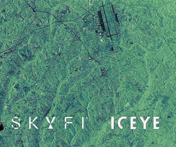
ICEYE's satellites employ a phased-array radar system that supports responsive tasking and multiple imaging modes. Available collection options range from spotlight modes with resolution of about 50 centimeters to wide-area scans covering more than 10,000 square kilometers at resolutions down to about 15 meters.
The companies highlight key features for ICEYE US Direct that include on-demand tasking of the ICEYE SAR constellation, all-weather day and night imaging, and an interface designed to simplify the process from ordering through data delivery. The platform architecture is described as addressing security and performance needs of government and enterprise customers, and the launch marks a new phase in the SkyFi-ICEYE US cooperation to expand access to SAR-based Earth observation for a global user base.
Related Links
SkyFi
ICEYE US
Earth Observation News - Suppiliers, Technology and Application
| Subscribe Free To Our Daily Newsletters |

| Subscribe Free To Our Daily Newsletters |