24/7 Space News
EARTH OBSERVATION
Alen Space begins SATMAR satellite validation over Bay of Algeciras
illustration only

Alen Space begins SATMAR satellite validation over Bay of Algeciras

by Robert Schreiber
Berlin, Germany (SPX) Dec 26, 2025

Alen Space has completed the first demonstrator pilot campaign of VDES technology using its SATMAR satellite over the Bay of Algeciras in southern Spain. Over the past week, the company worked with Egatel and the Port Authority of the Bay of Algeciras to run several operational tests in a real maritime setting.

In the first pilot, SATMAR supported message exchanges between a vessel and the port control center to adjust transit times, cut emissions, and improve coordination of ship movements. A second pilot used a drifting vessel as a proxy for an offshore buoy to send environmental and oceanographic measurements through VDES, illustrating how the system can support low-cost sensors over a secure maritime communications channel.

Alen Space also demonstrated long-range reception of AIS messages with SATMAR, allowing the satellite to track vessels beyond the reach of coastal monitoring stations. This capability extends conventional AIS coverage and supports traffic awareness in open-ocean regions.

Before the end of 2025, a final pilot in this campaign is planned with Oritia and Boreas, which will deploy a VDES transmission terminal at one of its meteorological stations in the Bay of Algeciras. Alen Space, Egatel, and additional partners plan further demonstration campaigns and pilots across other ports and use cases in the coming months.

SATMAR has been in orbit for six months after launching on 23 June 2025 aboard a SpaceX Falcon 9 rocket. Shortly after launch, the mission team established first contact and began in-orbit validation of the satellite's subsystems and payloads.

The mission's main objective is to demonstrate the feasibility of the VDES communication standard in orbit for the maritime sector, with the expectation that VDES will eventually supersede AIS. VDES supports bidirectional satellite links in the VHF band, including remote offshore areas, and is designed to improve the efficiency, safety, and environmental performance of maritime traffic while enabling new digital services in port environments.

SATMAR is a 6U nanosatellite developed entirely by Alen Space as part of a wider project that includes Egatel as a partner and the technology center Gradiant as a collaborator. The project receives funding from the Ports 4.0 program promoted by Puertos del Estado and the Spanish Port Authorities to support new applications for the maritime sector.

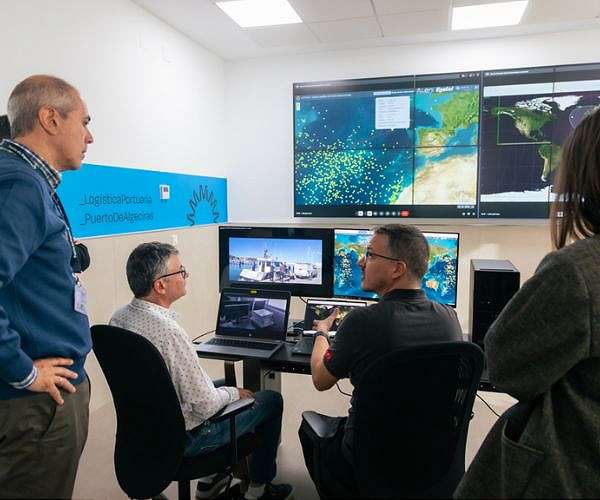
The satellite operates over Spain and adjacent waters, with use cases co-developed with the Port Authority of the Bay of Algeciras and maritime companies such as Oritia and Boreas. These scenarios focus on traffic management, environmental monitoring, and other operational services that can benefit from space-based VDES connectivity.

Guillermo Lamelas, CEO of Alen Space, highlighted the outcome of the initial pilots: "SATMAR has demonstrated its capability to provide bidirectional communications under the VDES standard in a real maritime environment. The validated functionalities are expected to deliver a substantial improvement in the efficiency, safety, and sustainability of maritime traffic, while simultaneously enabling new opportunities for the provision of digital services at sea. Satellite-based VDES ensures that vessels can maintain continuous communications with shore even in the high seas, receive emergency alerts, and access up-to-date operational information for route optimization, thereby contributing to reduced fuel consumption and associated emissions."

Related Links
Alen Space
Earth Observation News - Suppiliers, Technology and Application

Subscribe Free To Our Daily Newsletters
Tweet

RELATED CONTENT
The following news reports may link to other Space Media Network websites.
EARTH OBSERVATION
TanDEM X marks 15 years mapping Earth in 3D
Berlin, Germany (SPX) Dec 19, 2025
Exactly 15 years ago, in December 2010, the German TanDEM-X mission began routine radar imaging of Earth to produce a global digital elevation model, launching a long-running Earth observation program. Over six years, data from the twin radar satellites were processed into a consistent, high-precision digital elevation model that covers all land surfaces on the planet. This elevation model has since been adopted as a global topographic reference. DLR Chair of the Executive Board Anke Kaysser-Pyzal ... read more

EARTH OBSERVATION
ISS to change commanders before Soyuz crew leaves orbit

Lodestar Space wins SECP support to advance AI satellite awareness system

Micro nano robots aim to cut carbon buildup in closed life support systems

NASA extends ISS National Lab management contract through 2030

EARTH OBSERVATION
Hydrogen from ethanol reforming mapped as aviation fuel-cell pathway

Southern Launch to host INNOSPACE missions from South Australian spaceports

Rocket Lab completes first dedicated JAXA mission with Electron launch

Musk signals plan to launch IPO for SpaceX

EARTH OBSERVATION
GoMars model simulates Martian dust storms to improve mission safety

Maven stays silent after routine pass behind Mars

Ancient Martian brines left bromine rich fingerprints in jarosite minerals

NASA JPL Unveils Rover Operations Center for Moon, Mars Missions

EARTH OBSERVATION
Foreign satellites ride Kinetica 1 on new CAS Space mission

Experts at Hainan symposium call for stronger global space partnership

Triple Long March launches mark record day for Chinese space program

China prepares Qingzhou cargo ship for low cost resupply flights

EARTH OBSERVATION
K2 Space raises 250m to scale Mega class high power satellites

Beyond Gravity positions new modular satellite platform for European LEO missions

Private capital targets mission-critical software power and platforms in new space economy

Applied Aerospace and PCX create US flight and space hardware group

EARTH OBSERVATION
Digital twin successfully launched and deployed into space

Bible 1.0: How Ancient Canon Became Our First Large Language Models

Modena team outlines staged roadmap to cut emissions from metal laser 3D printing

Light driven process prints biocompatible plastic electrodes

EARTH OBSERVATION
Philosopher argues AI consciousness may remain unknowable

Can scientists detect life without knowing what it looks like

Ultra hot super Earth shows dense atmosphere over magma ocean

Hidden circumbinary giant planet emerges from decade old Gemini data

EARTH OBSERVATION
Uranus and Neptune may be rock rich worlds

SwRI links Uranus radiation belt mystery to solar storm driven waves

Looking inside icy moons

Saturn moon mission planning shifts to flower constellation theory

Subscribe Free To Our Daily Newsletters


The content herein, unless otherwise known to be public domain, are Copyright 1995-2024 - Space Media Network. All websites are published in Australia and are solely subject to Australian law and governed by Fair Use principals for news reporting and research purposes. AFP, UPI and IANS news wire stories are copyright Agence France-Presse, United Press International and Indo-Asia News Service. ESA news reports are copyright European Space Agency. All NASA sourced material is public domain. Additional copyrights may apply in whole or part to other bona fide parties. All articles labeled "by Staff Writers" include reports supplied to Space Media Network by industry news wires, PR agencies, corporate press officers and the like. Such articles are individually curated and edited by Space Media Network staff on the basis of the report's information value to our industry and professional readership. Advertising does not imply endorsement, agreement or approval of any opinions, statements or information provided by Space Media Network on any Web page published or hosted by Space Media Network. General Data Protection Regulation (GDPR) Statement Our advertisers use various cookies and the like to deliver the best ad banner available at one time. All network advertising suppliers have GDPR policies (Legitimate Interest) that conform with EU regulations for data collection. By using our websites you consent to cookie based advertising. If you do not agree with this then you must stop using the websites from May 25, 2018. Privacy Statement. Additional information can be found here at About Us.