| . |  |
. |
| . | |
. |
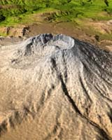
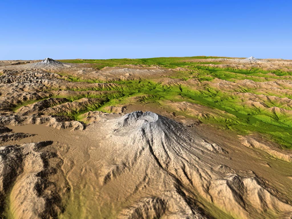
Seattle WA (AFP) Mar 08, 2005 Restive US volcano Mount St. Helens erupted Tuesday, sending a plume of smoke and ash nearly 12,000 meters (40,000 feet) into the air, officials said. But the eruption of the volcano, which killed 57 people when it erupted dramatically almost 25 years ago, did not appear to pose an immediate danger to people as the area is sparsely inhabited, they said. "There was an eruption at 5:30 pm local time (0130 GMT) and the cloud of ash is estimated at 36,000 feet (10,800 feet)," Rob Harper of the Washington State Emergency Management service told AFP. "We are monitoring the situation." KOMO television in the Oregon city of Portland showed the giant plume hanging over the crater of the volcano which rumbled back to life last October after years of silence. The plume prompted the Federal Aviation Administration to order air traffic to avoid the area. "Air traffic control will not allow any aircraft in the area of the plume," Mike Fergus of the FAA told AFP, adding that the column of smoke and ash topped out at 40,000 feet. "All the airlines and the airports know what's happening but it's the companies who will make the decision to cancel or delay any flights." It was unclear whether the volcano had spewed any lava, with officials confirming only that the mountain had belched smoke an ash over a largely uninhabited area of the states of Oregon and Washington. The eruption came five month after the most active in North America volcano began belching smoke and ash, as pressure grew under its cone. The latest eruption just ahead of the 25th anniversary of the deadly May 18, 1980 eruption that came after weeks of quakes, slides and tremors, of belching smoke, steam and ash. The 1980 eruption blew off the upper third of the mountain, leaving a gaping crater 2,050-foot (400-meter) deep, 1.7-mile (2.7-km) long and 1.3-mile (2-km) wide, and left 57 dead. The explosions shaved off 400 meters (1,300 feet) of the mountain's top, reducing it from 2,950 meters (9,680 feet) to 2,549 meters (8,363 feet). The blast sent clouds of volcanic ash high into the atmosphere, where jet streams carried it as far as the US eastern seaboard 3,000 miles (4,800 km) away. Towns and cities throughout the Pacific Northwest were buried in grey ash. The flash snow melt on the mountain triggered floods and mudslides, sending streams and rivers over their banks and destroying infrastructure for hundreds of miles around. The Columbia River, the main inland shipping channel from the Pacific Ocean, was clogged with volcanic sediment and eventually had to be dredged. Molten lava flows devastated forests and mountain meadows, creating a vast wasteland of mud, magma and ash. Mount St. Helens erupted again in 1986, but with nowhere near the same intensity. Related Links SpaceDaily Search SpaceDaily Subscribe To SpaceDaily Express
 Albuquerque NM (SPX) Mar 08, 2005
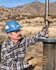
Geothermal researchers at Sandia National Laboratories have developed sensors that can be placed in hotter and higher-pressure underground environments than previous instruments, a capability that is allowing geologists worldwide to make more precise measurements of subterranean conditions before and after large earthquakes occur. |
|
| The content herein, unless otherwise known to be public domain, are Copyright 1995-2006 - SpaceDaily.AFP and UPI Wire Stories are copyright Agence France-Presse and United Press International. ESA PortalReports are copyright European Space Agency. All NASA sourced material is public domain. Additionalcopyrights may apply in whole or part to other bona fide parties. Advertising does not imply endorsement,agreement or approval of any opinions, statements or information provided by SpaceDaily on any Web page published or hosted by SpaceDaily. Privacy Statement |

