| . |  |
. |
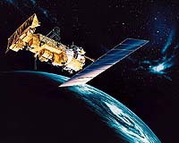
Greenbelt - Jun 03, 2002 A new environmental satellite, NOAA-M, is being planned for launch June 24 from Vandenberg Air Force Base, Calif., NOAA and NASA announced today. NOAA-M will lift off aboard an Air Force Titan II launch vehicle at 11:22 a.m. PDT (2:22 p.m. EDT). The launch window extends for approximately 10 minutes. "The NOAA-M satellite will improve weather forecasting and monitor environmental events around the world," said Conrad C. Lautenbacher, Jr., USN (ret.), Under Secretary of Commerce for Oceans and Atmosphere, and NOAA Administrator. "The satellite will enable continuity of data for monitoring events such as El Nino, droughts, volcanic ash, fires, and floods. In addition, it will support of the international COSPAS-SARSAT system by providing search and rescue capabilities essential for detection and location of ships, aircraft, and people in distress," Lautenbacher added. NOAA-M is the third in a series of five Polar-orbiting Operational Environmental Satellites (POES) with improved imaging and sounding capabilities that will operate over the next 10 years. Like other NOAA satellites, NOAA-M will collect meteorological data and transmit the information to users around the world to enhance weather forecasting. The data will be used primarily by NOAA's National Weather Service for its weather and climate forecasts. NOAA-M will be re-named NOAA-17 after achieving orbit. The polar-orbiting satellites monitor the entire Earth, tracking atmospheric variables and providing atmospheric data and cloud images. They track global weather patterns affecting the weather and climate of the United States. The satellites provide visible and infrared radiometer data for imaging purposes, radiation measurements, and temperature and moisture profiles. The polar orbiters' ultraviolet sensors also measure ozone levels in the atmosphere and are able to detect the ozone hole over Antarctica from mid-September to mid-November. Each day, these satellites send global measurements to NOAA's Command and Data Acquisition station computers, adding vital information to forecasting models, especially over the oceans, where conventional data are lacking. NOAA's environmental satellite system is composed of two types of satellites: Geostationary Operational Environmental Satellites (GOES) for national, regional, short-range warning and "now-casting"; and the polar-orbiting satellites for global forecasting and environmental monitoring. Both GOES and POES are necessary for providing a complete global weather monitoring system. Both also carry search and rescue instruments to relay signals from aviators and mariners in distress. These satellites are operated by NOAA's National Environmental Satellite, Data, and Information Service in Suitland, Md. NASA's Goddard Space Flight Center in Greenbelt, Md., is responsible for the construction, integration, launch and verification testing of the spacecraft, instruments and unique ground equipment. NASA turns operational control of the spacecraft over to NOAA after 21 days of comprehensive subsystem checkout. An on-orbit instrument performance verification period lasts an additional 24 days. Lockheed Martin Missiles and Space Co., Sunnyvale, Calif., built the spacecraft, under contract to Goddard. Data from the NOAA spacecraft are used by researchers within NASA's Earth Science Enterprise, a long-term research program designed to study Earth's land, oceans, atmosphere, ice and life as a total integrated system. Related Links NOAA Goddard Space Flight Center SpaceDaily Search SpaceDaily Subscribe To SpaceDaily Express
 Greenbelt - Jun 03, 2002
NASA researchers have created a tool that can predict El Nino events months before they occur, by linking variations in rainfall patterns over the Indian Ocean with developing El Ninos. Scott Curtis of the University of Maryland, Baltimore County's (UMBC) Joint Center for Earth Systems Technology (JCET), and Robert Adler of NASA's Goddard Space Flight Center in Greenbelt, Md., developed an El Nino Prediction Index (PI) formula that uses satellite-based rainfall data. |
|
| The content herein, unless otherwise known to be public domain, are Copyright 1995-2006 - SpaceDaily.AFP and UPI Wire Stories are copyright Agence France-Presse and United Press International. ESA PortalReports are copyright European Space Agency. All NASA sourced material is public domain. Additionalcopyrights may apply in whole or part to other bona fide parties. Advertising does not imply endorsement,agreement or approval of any opinions, statements or information provided by SpaceDaily on any Web page published or hosted by SpaceDaily. Privacy Statement |