| . |  |
. |
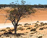
Brisbane - Sep 24, 2003 Intergraph Mapping and Geospatial Solutions has announced that the Department of Natural Resources and Mines, Queensland, Australia, has launched a land information management system based on open GeoMedia technology that will track pests. The department is responsible for maintaining land, water and vegetation, including minimizing the impact of pest plants and animals in a state that covers an area of 1.7 million square kilometers around a quarter of the Australian continent. The system, called PestInfo, is a digital mapping tool for local councils to record, manage and analyze pest information in Queensland. Pests are a significant issue in Queensland, with conservative estimates putting the annual total cost to the state at $600 million (AU) for weeds and $100 million for animals, not including environmental costs. PestInfo allows the department to take a strategic approach to pest management across boundaries and regions. With the increased quality of pest distribution data available from local government for state planning purposes, the state can improve pest response and control programs and raise awareness of pest issues in Queensland to promote a better quality of life for its residents. According to Marc Bryant, Pest Information Manager, Department of Natural Resources and Mines, Queensland, "In the mid-1990s, we recognized that computerized geographic recording would be effective in allocating state resources for pest management, but now a new Windows-based system was needed to address the requirements of Queensland's 128 councils. "We needed a user-friendly and cost-effective system that did not require proprietary geographic information system (GIS) software at each council site. PestInfo runs stand-alone on any computer while accessing existing GIS data in its native format. With PestInfo, each site can manage their data effortlessly and can provide better pest information to the state, which enables us to coordinate and improve overall pest management." Intergraph and the Department of Natural Resources and Mines created PestInfo using a development toolkit based on open GeoMedia technology. PestInfo provides highly flexible and user-friendly tools at the local level for pest management. The system provides the councils with functionality to enter new data on pest infestations and treatments directly from the field using a laptop or field notes and GPS capture; output cartographic maps; and run sophisticated queries to discover new relationships, for example between land use and pest infestations. Spatial data can be imported to PestInfo in various native formats for use as reference or new infestation records. Released in August 2003, PestInfo 4.0 has already been adopted by 75 percent of Queensland councils, compared with a 30 percent adoption rate for the previous system. The department is also making the system available to community groups and other Australian pest management authorities. Related Links PestInfo Intergraph Mapping and Geospatial Solutions SpaceDaily Search SpaceDaily Subscribe To SpaceDaily Express
 Troy - Sep 24, 2003
MapInfo Corporation has announced the availability of RiskDataInfo, a comprehensive data set of weather and natural hazards for its Insurance Decision Solution Suite (IDSS), the company's industry-leading insurance visualization solution. Now, insurance companies and reinsurers can visually analyze and consider the potential impact of weather and other natural hazards in relation to a specific location. |
|
| The content herein, unless otherwise known to be public domain, are Copyright 1995-2006 - SpaceDaily.AFP and UPI Wire Stories are copyright Agence France-Presse and United Press International. ESA PortalReports are copyright European Space Agency. All NASA sourced material is public domain. Additionalcopyrights may apply in whole or part to other bona fide parties. Advertising does not imply endorsement,agreement or approval of any opinions, statements or information provided by SpaceDaily on any Web page published or hosted by SpaceDaily. Privacy Statement |