| . |  |
. |
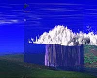
Greenbelt MD (SPX) Apr 25, 2007 Far beyond signaling the day's weather, clouds play a key role in regulating and understanding climate. A team of researchers recently completed a project to confirm what NASA satellites are telling us about how changes in clouds can affect climate in the coldest regions on Earth. Clouds and their traits - their temperature, depth, size and shape of their droplets - play a significant role in how much of the sun's radiation reaches Earth's surface and what amount of heat energy Earth reflects back into the atmosphere. In 2006, NASA simultaneously launched a pair of satellites, CloudSat and the Cloud-Aerosol Lidar and Infrared Pathfinder Satellite Observation (CALIPSO), which together use state-of-the-art instruments as they orbit the globe to reveal detailed information about clouds and their effect on climate. Scientists predict that certain changes in cloud properties can accelerate climate change. "The polar regions are very sensitive indicators of climate change," said Deborah Vane, project manager and deputy principal investigator for the CloudSat mission at NASA's Jet Propulsion Laboratory, Pasadena, Calif. "It's been well reported now that the polar ice caps are undergoing net melting. There's a complicated interaction between clouds and climate in polar regions that can contribute to temperature changes, and, in turn, speed the rate at which ice melts." As part of a major experiment to unlock some of the particular mysteries of cold-season clouds, researchers from NASA; the Meteorological Service of Canada in Toronto; Colorado State University, Fort Collins; and the Desert Research Institute, Reno, Nev., employed ground-based sensors in remote areas of Canada and sensors aboard aircraft that flew over the region this winter to confirm information CloudSat and CALIPSO provided. The aircraft flew beneath CloudSat and CALIPSO 21 times during the experiment, which took place between Oct. 31, 2006, and March 1, 2007. Researchers were surprised to find extremely high ice water content in snowstorms generated by the open waters of the Great Lakes, much higher than expected as snowstorm cloud systems are typically very shallow without ample depth to contain much ice and water content. Also, embedded layers of significant amounts of liquid water were frequently found in very cold multi-layer cloud systems - systems that were known prior to have temperatures high enough to freeze cloud water, resulting mostly in clouds laced with ice. Researchers consistently found liquid water in these clouds, which posed a new challenge to their assumptions and to models of these types of clouds. "This campaign gives us a snapshot in time that, when combined with additional satellite information in the future, should give us more confidence in what the satellites are telling us about cloud properties," said Vane. "Are the properties of the clouds changing over time? Just how much are they changing, and what is the effect on the ground below? This research will ultimately help us understand what's happening with climate in the polar regions, a part of the world where accurate data measurements can be difficult to gather without satellites." CloudSat peers into clouds from hundreds of miles above to allow researchers a sneak peek into just how cloud droplets change to become rain or snow. CALIPSO uses laser technology called lidar to gather data globally that researchers will use to analyze how clouds and aerosols affect the atmosphere. "What's unique about this field experiment is that we're the only research group doing winter cloud validation," said David Hudak, a research scientist at the Meteorological Service of Canada, and the principal investigator of the field experiment. "Others have focused solely on confirming satellite data from warm-season clouds. Cold-season clouds have completely different traits, and it's those specific properties that contribute to some of the changes we see in climate in the Arctic and Antarctic." Results from the Canadian field campaign will also help researchers confirm statistics in advance of a major satellite mission - NASA's Global Precipitation Measurement (GPM) satellite, set to launch in 2013 - that will measure liquid rain and seeks to detect and estimate falling snow. "Data from this experiment will help GPM observe snow as it is falling, which is very difficult to do because snow crystals are so complex. We really want to delve into the nuances of their shape, how fast they fall, the depth of the snowfall clouds, and changes in cloud location," said physical scientist Gail Skofronick Jackson, deputy project scientist for the Global Precipitation Measurement mission at NASA's Goddard Space Flight Center, Greenbelt, Md. "This field campaign is exciting because it can help us get a better fix on how to do this as we gear up for launching GPM." During the experiment, a turboprop aircraft carrying lidar and radar nearly identical to instruments aboard the satellites flew through snow clouds. Probes on the aircraft's wings sampled cloud and aerosol properties, including the size and shape of snowflakes and total amount of snowflakes suspended in the clouds. On the ground, the research team used dual precipitation radar, two microwave radiometers, and a host of ground sensors. Ground sensors that sampled the falling precipitation and estimated its rate and type were housed at a rural post in southern Ontario north of Toronto. "Experiments like this boost our ability to rely on the accuracy of these satellite observations," said Jackson. "At a time when nations around the globe are devoting tremendous resources to studying the polar regions as part of the International Polar Year, this experiment really gets us on the right path to learning more about the ins and outs of climate in this critical part of the world." Email This Article
Related Links
 Singapore (AFP) April 20, 2007
There is no easy solution to the Indonesian haze which has blighted southeast Asia every year for the past decade, a UN-backed conference on climate change was told Friday. Experts said the problem, largely caused by using fire to clear land for agriculture, is not simply about preserving the environment but also involves addressing poverty and changing traditional practices. |
|
| The content herein, unless otherwise known to be public domain, are Copyright 1995-2006 - SpaceDaily.AFP and UPI Wire Stories are copyright Agence France-Presse and United Press International. ESA PortalReports are copyright European Space Agency. All NASA sourced material is public domain. Additionalcopyrights may apply in whole or part to other bona fide parties. Advertising does not imply endorsement,agreement or approval of any opinions, statements or information provided by SpaceDaily on any Web page published or hosted by SpaceDaily. Privacy Statement |