. 24/7 Space News .
EARTH OBSERVATION
Cracking the Code in Satellite Data
by Staff Writers
Boston MA (SPX) May 02, 2016


File image.

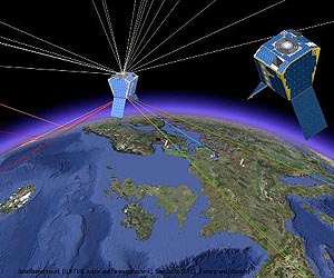
The challenge: New constellations of small satellites will launch in the near future, generating a deluge of imagery for analysts to sift through to find patterns and answers to perplexing issues.

To help prepare for the onslaught, Draper is sponsoring a contest for bright/creative/audacious contestants to demonstrate the skills of intelligence analysts or crime scene investigators as they develop online tools to analyze satellite imagery and solve this vexing dilemma.

The contest: Draper is sponsoring the Chronos Data Science Contest, which will monetarily reward competitors who come in first, second or third place for developing new tools to solve a puzzle using daily aerial pictures of California as a stand-in for satellite images.

Assembling a week's worth of pictures of the same location in proper chronological order requires contestants to create and demonstrate new tools that can be applied to the expected hundreds of terabytes of daily data from the new constellations.

According to Kim Slater, who leads Draper's small satellite initiative, "This work will ultimately help analysts uncover trends related to climate change, natural disasters and public health crises.

Combining more frequent imagery with big data analytics will yield more actionable intelligence that enables better decision-making," Slater said.

Draper is providing the aerial imagery and funding for the contest, which begins on April 29 and is run by Kaggle, a platform for predictive modeling and analytics competitions. First prize is worth $30,000, followed by $20,000 and $10,000 for runners up.

Draper's own work in data science includes models that predicted economic, political and cultural characteristics with an 85 percent success rate using commercial satellite imagery of Afghanistan. The company is demonstrating broader effectiveness of those models using imagery of Sub-Saharan Africa under contract to the National Geospatial-Intelligence Agency.

Draper is also contributing expertise in parallel processing, image database analysis and pattern recognition to BridgeSat, Inc. as it plans for a network of optical communications ground stations and laser-linked communications satellites, enabling the system to deliver massive amounts of data from planned small satellite constellations in a fast, cost-effective manner.

As a not-for-profit engineering research and development company, Draper focuses on the design, development and deployment of advanced technological solutions for the world's most challenging and important problems. We provide engineering solutions directly to government, industry, and academia; work on teams as prime contractor or subcontractor; and participate as a collaborator in consortia. We provide unbiased assessments of technology or systems designed or recommended by other organizations - custom designed, as well as commercial-off-the-shelf.


Thanks for being here;
We need your help. The SpaceDaily news network continues to grow but revenues have never been harder to maintain.

With the rise of Ad Blockers, and Facebook - our traditional revenue sources via quality network advertising continues to decline. And unlike so many other news sites, we don't have a paywall - with those annoying usernames and passwords.

Our news coverage takes time and effort to publish 365 days a year.

If you find our news sites informative and useful then please consider becoming a regular supporter or for now make a one off contribution.
SpaceDaily Contributor
$5 Billed Once


credit card or paypal
SpaceDaily Monthly Supporter
$5 Billed Monthly


paypal only


.


Related Links
Draper
Earth Observation News - Suppiliers, Technology and Application


Comment on this article via your Facebook, Yahoo, AOL, Hotmail login.

Share this article via these popular social media networks
del.icio.usdel.icio.us DiggDigg RedditReddit GoogleGoogle

Previous Report
EARTH OBSERVATION
NTT DATA and RESTEC achieve full global coverage with AW3DTM
Tokyo, Japan (SPX) May 02, 2016
NTT DATA and the Remote Sensing Technology Center of Japan (RESTEC) have announced that their global digital 3D map service, AW3DTM, became the world's first five-meter-resolution 3D map covering all global land spaces, including Antarctica. AW3DTM, the world's most precise global 3D map service, uses a digital elevation model (DEM) with five-meter resolution based on some three million sa ... read more


EARTH OBSERVATION
First rocket made ready for launch at Vostochny spaceport

Supernova iron found on the moon

Russia to shift all Lunar launches to Vostochny Cosmodrome

Lunar lava tubes could help pave way for human colony

EARTH OBSERVATION
Opportunity completes mini-walkabout

Curiosity Mars Rover crosses rugged plateau

Mars' surface revealed in unprecedented detail

Space X's Red Dragons to start Mars exploration in 2018

EARTH OBSERVATION
US to move more assets into deep space over next 4 years

Simulators give astronauts glimpse of future flights

When technology bites back

Menstruation in spaceflight: Options for astronauts

EARTH OBSERVATION
South China city gears up for satellite tourism

China's long march into space

China's top astronaut goes to "space camp"

China open to Sino-US space cooperation

EARTH OBSERVATION
Russia delays space crew's return to Earth

15 years of Europe on the International Space Station

US-Russia Space Projects Set Example of Good Cooperation

Russia, US discuss boosting efficiency of cooperation at ISS

EARTH OBSERVATION
SpaceX vows to send capsule to Mars by 2018

Russia May Launch Upgraded Proton-M Rocket on May28

India to test Reusable Launch Vehicle in June

Soyuz demonstrates Arianespace mission flexibility

EARTH OBSERVATION
On the Road to Finding Other Earths

Kepler spacecraft recovered and returned to the K2 Mission

Lone planetary-mass object found in family of stars

University of Massachusetts Lowell PICTURE-B Mission Completed

EARTH OBSERVATION
It takes more than peer pressure to make large microgels fit in

Folding molecules into screw-shaped structures

Engineers develop micro-sized, liquid-metal particles for heat-free soldering

Speedy bridge repair


The content herein, unless otherwise known to be public domain, are Copyright 1995-2024 - Space Media Network. All websites are published in Australia and are solely subject to Australian law and governed by Fair Use principals for news reporting and research purposes. AFP, UPI and IANS news wire stories are copyright Agence France-Presse, United Press International and Indo-Asia News Service. ESA news reports are copyright European Space Agency. All NASA sourced material is public domain. Additional copyrights may apply in whole or part to other bona fide parties. All articles labeled "by Staff Writers" include reports supplied to Space Media Network by industry news wires, PR agencies, corporate press officers and the like. Such articles are individually curated and edited by Space Media Network staff on the basis of the report's information value to our industry and professional readership. Advertising does not imply endorsement, agreement or approval of any opinions, statements or information provided by Space Media Network on any Web page published or hosted by Space Media Network. General Data Protection Regulation (GDPR) Statement Our advertisers use various cookies and the like to deliver the best ad banner available at one time. All network advertising suppliers have GDPR policies (Legitimate Interest) that conform with EU regulations for data collection. By using our websites you consent to cookie based advertising. If you do not agree with this then you must stop using the websites from May 25, 2018. Privacy Statement. Additional information can be found here at About Us.