|
|
| . |  |
. |
|
|
by Staff Writers Washington DC (SPX) May 29, 2009
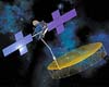
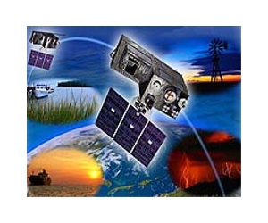
The Commerce Department's National Oceanic and Atmospheric Administration (NOAA) has announced that Harris Corporation - Government Communications Systems Division of Melbourne, Fla. has been selected to develop the GOES-R ground system, which will capture, process and distribute information from NOAA's next generation geostationary satellite series to users around the world. The GOES-R series of spacecraft, set to begin launching in 2015, is expected to double the clarity of today's satellite imagery and provide at least 20 times more atmospheric observations from space. The ground system is composed of computers which control the satellite and process the satellite's data into products scientists can use. "NOAA's satellites are a crucial tool for weather forecasters and scientists. They help predict the path of dangerous storms and give us a greater understanding of our changing climate," Undersecretary of Commerce for Oceans and Atmosphere and NOAA Administrator Jane Lubchenco, Ph.D. said. "This award will generate nearly 300 jobs for the aerospace industry and will ensure NOAA remains on the cutting edge of satellite technology." The contract, which has an estimated value of $736 million, requires Harris Corporation to design, develop, test and implement the GOES-R ground system. The award was the result of a full and open competitive procurement process following federal acquisition regulations. Forecasters from NOAA's National Weather Service, one of the primary users of GOES-R data, will see detailed images of potentially deadly hurricanes every 30 seconds, instead of every 7.5 minutes, which the current system provides. Experts with the GOES-R program, and NOAA's national data centers, will use the Comprehensive Large Array-data Stewardship System (CLASS) to preserve the satellite data for future climate science research. The GOES-R ground system will be developed and operated at the NOAA Satellite Operations Facility in Suitland, Md. and at the Wallops Command and Data Acquisition Station in Wallops Island, Va. The system will be designed to ensure continuity of operations during severe weather and other threat scenarios. Earlier this month, NOAA and NASA announced that Lockheed Martin Space Systems Co., was chosen to build the GOES-R satellites through a separate contract. NOAA funds, manages and will operate the GOES-R program. NASA's Goddard Space Flight Center oversees the acquisition of the GOES-R spacecraft and instruments for NOAA. NOAA understands and predicts changes in the Earth's environment, from the depths of the ocean to the surface of the sun, and conserves and manages our coastal and marine resources.
Related Links National Oceanic and Atmospheric Administration (NOAA) Space Technology News - Applications and Research
|
|
| The content herein, unless otherwise known to be public domain, are Copyright 1995-2014 - Space Media Network. AFP, UPI and IANS news wire stories are copyright Agence France-Presse, United Press International and Indo-Asia News Service. ESA Portal Reports are copyright European Space Agency. All NASA sourced material is public domain. Additional copyrights may apply in whole or part to other bona fide parties. Advertising does not imply endorsement,agreement or approval of any opinions, statements or information provided by Space Media Network on any Web page published or hosted by Space Media Network. Privacy Statement |
 del.icio.us
 Digg
Digg Reddit
 Google