| . |  |
. |
Northrop Grumman and its teammate Raytheon have won a program definition and risk reduction contract for the nation's next-generation Geostationary Operational Environmental Satellite (GOES) system, GOES-R. The contract was awarded by the National Oceanic and Atmospheric Administration (NOAA). The $10 million, six-month contract includes options for a potential additional $20 million and a 16-month extension. During the program definition and risk reduction phase, the team will produce trade studies comparing the performance and cost of alternative system architectures, develop system definition through allocating requirements and operational functions, initiate system and segment designs for products to be developed in the subsequent program phase, execute steps to reduce key risk areas and demonstrate the team's ability to meet the government's end-to-end system performance requirements for NOAA's missions. "The GOES system has been an essential cornerstone of weather observations and forecasting for 25 years," said Alexis Livanos, president of Northrop Grumman's Space Technology sector. "Our team will draw on its years of expertise in design, development and integration of large complex environmental systems to create an affordable program that places greatly improved data into the user's hands." Northrop Grumman and Raytheon have extensive experience in building and integrating remote sensing spacecraft, and managing high-volume command, control and data systems. Just recently, NASA's Northrop Grumman-built Aqua spacecraft contributed to prediction and disaster-relief efforts to all of the recent hurricanes by providing authorities with data on sea surface temperatures, rainfall and flooding. GOES-R will collect 100 times more data and scan the Earth three-to-five times faster than previous systems, providing improved spatial, spectral and temporal resolution. These advances will provide more advanced environmental products and services that can be used by weather forecasters for many applications, including hurricane track and intensity forecasts and monitoring of coastal, harbor and inland waterways for fishing, contamination and environmental change analysis. Improved products and services are critical to NOAA's missions for monitoring weather and water, climate, oceans and ecosystems, and commerce and transportation. Related Links SpaceDaily Search SpaceDaily Subscribe To SpaceDaily Express 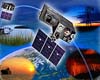 Palo Alto CA (SPX) Oct 12, 2005
The Lockheed Martin Advanced Technology Center has submitted to the NASA Goddard Space Flight Center a formulation phase study proposal for the Geostationary Lightning Mapper instrument that will fly on the GOES-R Series environmental satellites.
|
| ||||||||||
| The content herein, unless otherwise known to be public domain, are Copyright 1995-2016 - Space Media Network. All websites are published in Australia and are solely subject to Australian law and governed by Fair Use principals for news reporting and research purposes. AFP, UPI and IANS news wire stories are copyright Agence France-Presse, United Press International and Indo-Asia News Service. ESA news reports are copyright European Space Agency. All NASA sourced material is public domain. Additional copyrights may apply in whole or part to other bona fide parties. Advertising does not imply endorsement, agreement or approval of any opinions, statements or information provided by Space Media Network on any Web page published or hosted by Space Media Network. Privacy Statement All images and articles appearing on Space Media Network have been edited or digitally altered in some way. Any requests to remove copyright material will be acted upon in a timely and appropriate manner. Any attempt to extort money from Space Media Network will be ignored and reported to Australian Law Enforcement Agencies as a potential case of financial fraud involving the use of a telephonic carriage device or postal service. |
