| . |  |
. |
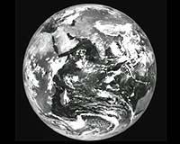
India will undertake the task of providing satellite imaging and aerial services for creating digital mapping of Maldives and for setting up of a Remote Sensing Unit in the Maldives for analyzing and updating the data. A Memorandum of Understanding to this effect was signed January 22, 2004 in Male, Maldives by Mr S M Gavai, High Commissioner of India in the Maldives on behalf of the Government of India and Mr Hamdun Hameed, Minister of Planning and National Development on behalf of the Government of Maldives. The project will commence by the end of January 2004. Speaking on the occasion, High Commissioner Mr S M Gavai said that the project would add a new dimension to the extensive and wide-ranging cooperation between the two countries in various areas and will further contribute to the strengthening of the extremely close and friendly relations between them. He added that India was happy to have been able to provide this assistance to the Maldives and conveyed that India would be willing to consider cooperation on a continuing basis in this area if desired by the Government of the Maldives. Minister of Planning and National Development, Mr Hamdun Hameed, expressed the gratitude of the Government of Maldives for the assistance rendered by India in this important area and termed the project a symbol of the warm and friendly ties between the two countries. He added that the project would meet a crucial need of the Maldivian Government. The National Remote Sensing Agency (NRSA), Hyderabad, of the Department of Space (DOS) will execute this project. The project will involve creation of medium scale maps of the entire Maldives and large scale maps of selected areas. Along with ground reference points, these maps will be used for generating a Geographical Information System (GIS), which can be updated periodically. NRSA will also assist in setting up the centre in Male for maintaining the GIS and for using satellite remote sensing data for thematic studies of land and oceans. NRSA will provide training to the Maldivian scientists for running the centre and interpreting the remote sensing data. The MOU signed today is a sequel to the visit of the President of Maldives, H E Mr Maumoon Abdul Gayyum, to NRSA, Hyderabad, in August, 2000 when he was apprised of India's capability in remote sensing area. Related Links ISRO SpaceDaily Search SpaceDaily Subscribe To SpaceDaily Express  Monterrey (AFP) Jan 12, 2004
US President George W. Bush announced Monday that the United States and India would deepen cooperation on civilian nuclear activities, civilian space programs and high-technology trade.
|
| ||||||||||
| The content herein, unless otherwise known to be public domain, are Copyright 1995-2016 - Space Media Network. All websites are published in Australia and are solely subject to Australian law and governed by Fair Use principals for news reporting and research purposes. AFP, UPI and IANS news wire stories are copyright Agence France-Presse, United Press International and Indo-Asia News Service. ESA news reports are copyright European Space Agency. All NASA sourced material is public domain. Additional copyrights may apply in whole or part to other bona fide parties. Advertising does not imply endorsement, agreement or approval of any opinions, statements or information provided by Space Media Network on any Web page published or hosted by Space Media Network. Privacy Statement All images and articles appearing on Space Media Network have been edited or digitally altered in some way. Any requests to remove copyright material will be acted upon in a timely and appropriate manner. Any attempt to extort money from Space Media Network will be ignored and reported to Australian Law Enforcement Agencies as a potential case of financial fraud involving the use of a telephonic carriage device or postal service. |