| . |  |
. |
Earth Search Sciences, Inc. Larry Vance, Chief Executive Officer of Earth Search Sciences, Inc.(ESSI) says he is pleased with the results that Noranda Inc. has accomplished using ESSI's revolutionary remote sensing technology. Vance's reaction was in response to a seminar conducted by Mike Peshko of Noranda Inc./ Falconbridge Ltd. Which showed that his company is having success in identifying "anomalies" (copper and other metal deposits) using Earth Search Science's technology for mineral exploration in Chile. According to Peshko, the results of One Phase of Noranda's Hyperspectral Targeting in Chile was 145 Targets being followed-up and more than 20 new Porphyry Systems (previously unknown to Noranda) being discovered. Peshko concluded that by using hyperspectral remote sensing technology, the Exploration Cycle is advanced and could potentially save the company 2-4 years of regional exploration, a factor which not only would save time but also money. Vance says the results of Noranda's activities could be potentially beneficial to ESSI as well. According to an agreement between Earth Search Sciences, Inc. and Noranda Inc., ESSI is entitled to receive fees for services and net smelter royalties or net profit royalties from certain discoveries Noranda makes using ESSI's technology. In addition, the agreement grants net smelter royalties to ESSI for 2.5 percent of revenues also a 5 to 20 percent net profit interests on any mineral discoveries leading to production on land not currently owned or optioned by the Noranda Group. While existing satellite and remote sensing technology provides the ability to identify objects primarily by shape or spectral response, Earth Search Science's revolutionary hyperspectral imaging, by measuring the degree of spectral reflectance of solar energy across the spectrum, allows the user to identify minerals by their diagnostic reflectance patterns. Earth Search hyperspectral information products can be used for a variety of resource, environmental, and security applications. The seminar was part of a one day workshop focusing on the practical aspects of remote sensing technology for mineral exploration conducted at the Prospectors and Developers Association of Canada's (PDAC) International Convention held in Toronto recently. Related Links Earth Search Sciences SpaceDaily Search SpaceDaily Subscribe To SpaceDaily Express  Paris - Apr 21, 2004
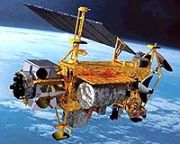
NASA's CALIPSO (Cloud-Aerosol Lidar and Infrared Pathfinder Satellite Observations) instruments completed a successful series of ground tests at Ball Aerospace & Technologies Corp., Boulder, Colo. These instruments will improve worldwide climate predictions and provide a better understanding of how airborne particles and clouds affect our atmosphere.
|
| ||||||||||
| The content herein, unless otherwise known to be public domain, are Copyright 1995-2016 - Space Media Network. All websites are published in Australia and are solely subject to Australian law and governed by Fair Use principals for news reporting and research purposes. AFP, UPI and IANS news wire stories are copyright Agence France-Presse, United Press International and Indo-Asia News Service. ESA news reports are copyright European Space Agency. All NASA sourced material is public domain. Additional copyrights may apply in whole or part to other bona fide parties. Advertising does not imply endorsement, agreement or approval of any opinions, statements or information provided by Space Media Network on any Web page published or hosted by Space Media Network. Privacy Statement All images and articles appearing on Space Media Network have been edited or digitally altered in some way. Any requests to remove copyright material will be acted upon in a timely and appropriate manner. Any attempt to extort money from Space Media Network will be ignored and reported to Australian Law Enforcement Agencies as a potential case of financial fraud involving the use of a telephonic carriage device or postal service. |