| . |  |
. |
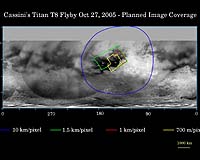
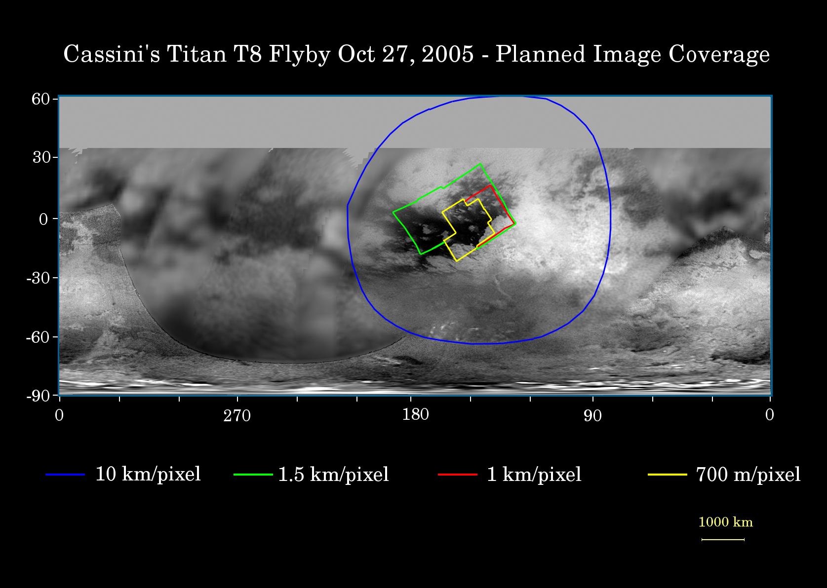
This map of Titan's surface illustrates the regions that will be viewed by Cassini's imaging cameras during the spacecraft's close flyby of Titan on Oct. 28, 2005. At closest approach, the spacecraft is expected to pass approximately 1,400 kilometers (800 miles) above the moon's surface. The colored lines delineate the regions that will be imaged at differing resolutions. The highest resolution imaging coverage during the flyby will be of the eastern portion of the dark region called Shangri-la and the boundary between Shangri-la and bright Xanadu. Several of the major "islands" in eastern Shangri-la will be featured, including faculae (or bright spots) which have the provisional names Kerguelen, Vis, Crete and Tortola. These bright features on Titan are named for island features from Earth. The map shows only brightness variations on Titan's surface (the illumination is such that there are no shadows and no shading due to topographic variations). Previous observations indicate that, due to Titan's thick, hazy atmosphere, the sizes of surface features that can be resolved are a few to five times larger than the actual pixel scale labeled on the map. The images for this global map were obtained using a narrow band filter centered at 938 nanometers - a near-infrared wavelength (invisible to the human eye) at which light can penetrate Titan's atmosphere to reach the surface and return through the atmosphere to be detected by the camera. The images have been processed to enhance surface details. Related Links Cassini-Huygens at JPL Cassini Imaging Team SpaceDaily Search SpaceDaily Subscribe To SpaceDaily Express  Tuscon AZ (SPX) Oct 21, 2005
University of Arizona scientists say that the peculiar clouds at middle latitudes in Titan's southern hemisphere may form in the same way as distinct bands of clouds form at Earth's equator.
|
| ||||||||||
| The content herein, unless otherwise known to be public domain, are Copyright 1995-2016 - Space Media Network. All websites are published in Australia and are solely subject to Australian law and governed by Fair Use principals for news reporting and research purposes. AFP, UPI and IANS news wire stories are copyright Agence France-Presse, United Press International and Indo-Asia News Service. ESA news reports are copyright European Space Agency. All NASA sourced material is public domain. Additional copyrights may apply in whole or part to other bona fide parties. Advertising does not imply endorsement, agreement or approval of any opinions, statements or information provided by Space Media Network on any Web page published or hosted by Space Media Network. Privacy Statement All images and articles appearing on Space Media Network have been edited or digitally altered in some way. Any requests to remove copyright material will be acted upon in a timely and appropriate manner. Any attempt to extort money from Space Media Network will be ignored and reported to Australian Law Enforcement Agencies as a potential case of financial fraud involving the use of a telephonic carriage device or postal service. |