|
|
| . |  |
. |
|
|
by Staff Writers Baltimore MD (SPX) Nov 29, 2011
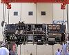
A consortium led by researchers at the Johns Hopkins University Applied Physics Laboratory (APL) is proposing a geoscience program that would give scientists the first continuous real-time look at the Earth's surface and atmosphere through a global network of sensors. Called GEOScan, the program would focus on providing critical data to the global scientific community on topics including climate, atmosphere, oceans, gravity and space weather. It would be a hosted payload on the Iridium NEXT constellation and use the satellite constellation's real-time data link. GEOScan would establish the first globally networked orbital observation facility and collect data to benefit students, scientists, policy makers and the public. GEOScan would begin transmitting information from space in 2015. "This is a key opportunity to solve critical global science questions that could go unanswered without these real-time measurements," says APL's Lars Dyrud, chief scientist for GEOScan. "By taking advantage of the significant opportunity provided by Iridium NEXT - to place a low-cost payload on satellites already headed to space - we can reduce the cost barriers to collecting, transmitting and distributing important scientific information about Earth." Hosted payloads use available capacity on commercial satellites to "piggyback" space-bound technology and instruments. "There is no doubt that GEOScan has an amazing potential to revolutionize how we see and study the dynamic Earth environment," adds Therese Moretto Jorgensen, a program director at the National Science Foundation, which supported a feasibility study of the GEOScan concept. GEOScan would use a single "SensorPOD" slot on each of the 66-plus NEXT, low-Earth orbiting communications satellites. Only about the size of a shoebox, (7.9 in x 7.9 in x 5.5 in) each the SensorPOD would carry instruments to image the Earth and characterize the space environment. They would also measure reflected sunlight and infrared radiation to provide the most precise measurements yet for climate models. GEOScan would also enable improved disaster relief and humanitarian assistance efforts by providing affordable real-time imagery. In addition, says Dyrud, a continuous set of globally distributed gravity measurements provided by GeoSCAN would offer a new look at Earth's global gravity field, including data on ocean currents, sea level change, atmospheric variations, movements of solid Earth and the melting of polar ice and glaciers. GEOScan includes a "Hosted Sensor" program that provides an opportunity for university researchers and students, as well as small businesses, to address novel science topics and test new instruments and technologies in space at a low-cost. More than 100 volunteer scientists and engineers are working to implement the GEOScan program through a future proposal to NSF. This committee, led by APL, is made up of scientific experts from a variety of geosciences disciplines including space, atmosphere, oceans and Earth science. "I am extremely grateful to all of the scientists who have volunteered their time and effort to pursue this exciting idea and thoroughly explore the opportunity for implementing it," says NSF's Jorgensen.
Related Links GEOScan at APL Laboratory Earth Observation News - Suppiliers, Technology and Application
|
|
| The content herein, unless otherwise known to be public domain, are Copyright 1995-2014 - Space Media Network. AFP, UPI and IANS news wire stories are copyright Agence France-Presse, United Press International and Indo-Asia News Service. ESA Portal Reports are copyright European Space Agency. All NASA sourced material is public domain. Additional copyrights may apply in whole or part to other bona fide parties. Advertising does not imply endorsement,agreement or approval of any opinions, statements or information provided by Space Media Network on any Web page published or hosted by Space Media Network. Privacy Statement |
 del.icio.us
 Digg
Digg Reddit
 Google