| . |  |
. |
The last definitive geologic map of North America was published before the theory of plate tectonics was widely accepted, back in the days when impact craters were known simply as "anomalies" and knowledge of ocean floor geology was in its infancy. This week the Geological Society of America (GSA) introduces the 2005 Geologic Map of North America. It's like no other in its representation of the grand architecture of the continent. A work of beauty as well as science, the map is printed in 11 colors with approximately 700 shades and patterns. It distinguishes more than 900 rock units, 110 of which are off-shore. It depicts more than seven times as many on-land units as the 1965 map. Perhaps its most significant additions are detailed features of the seafloor, including spreading centers, seamount chains, and subduction zones. "Our knowledge of the Earth and how it works has grown exponentially over the last 40 years," said Jack Hess, Executive Director of GSA. "We are pleased and excited to offer this great mapping achievement to the scientific community." The map is the result of a cooperative effort by GSA, the U.S. Geological Survey (USGS), the Geological Survey of Canada (GSC), and the Woods Hole Oceanographic Institution (WHOI). John C. Reed Jr. (USGS) and John O. Wheeler (GSC) compiled the on-land geology, while Brian E. Tucholke (WHOI) mapped and compiled the seafloors. The Pikes Peak Lithographing Company, Colorado Springs, Colorado, printed the map. More than twenty years in the making, the map illustrates approximately 15% of Earth's surface. It spans an area from the North Pole to Venezuela and from Ireland to Siberia. The map's developers describe it as a source for new interpretations of North American geology and insights into the evolution of the continent. "It will also aid in the discovery of mineral and energy resources, increase our ability to understand and mitigate geological hazards, and support improvements in land and resource management," said John Wheeler of the Geological Survey of Canada. Unlike its predecessor, the map is not a static end-product. Because it was produced with digital technology, a digital database is planned by David Soller of the U.S. Geological Survey. According to Soller, "Geoscientists for years to come will be able to access and analyze the data behind the map. This will stimulate additional research, expanding our body of knowledge at an increasingly rapid rate." The map is available for purchase through the Geological Society of America. Related Links Geological Society of America Woods Hole Oceanographic Institution SpaceDaily Search SpaceDaily Subscribe To SpaceDaily Express 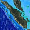 Copenhagen (AFP) Jan 31, 2005
The Indonesian islands of Sumatra moved only 20 centimeters (7.9 inches) on average after last month's Asian earthquake and tsunami, and not dozens of meters as previously feared, media reported on Monday, quoting calculations by the Danish Space Center.
|
| ||||||||||
| The content herein, unless otherwise known to be public domain, are Copyright 1995-2016 - Space Media Network. All websites are published in Australia and are solely subject to Australian law and governed by Fair Use principals for news reporting and research purposes. AFP, UPI and IANS news wire stories are copyright Agence France-Presse, United Press International and Indo-Asia News Service. ESA news reports are copyright European Space Agency. All NASA sourced material is public domain. Additional copyrights may apply in whole or part to other bona fide parties. Advertising does not imply endorsement, agreement or approval of any opinions, statements or information provided by Space Media Network on any Web page published or hosted by Space Media Network. Privacy Statement All images and articles appearing on Space Media Network have been edited or digitally altered in some way. Any requests to remove copyright material will be acted upon in a timely and appropriate manner. Any attempt to extort money from Space Media Network will be ignored and reported to Australian Law Enforcement Agencies as a potential case of financial fraud involving the use of a telephonic carriage device or postal service. |