| . |  |
. |
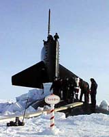
The discovery that an ocean ridge under the Arctic ice cap is unexpectedly volcanically active and contains multiple hydrothermal vents may cause scientists to modify a decades-long understanding of how ocean ridges work to produce the Earth's crust. The new results, which come from a study of the Gakkel Ridge, one of the slowest spreading ridges on Earth, have broad implications for the understanding of the globe-encircling mid-ocean ridge system where melting of the underlying mantle creates the ocean floor. In two articles appearing in the June 26 edition of the journal Nature, scientists supported by the National Science Foundation (NSF) and Deutsche Forschungsgemeinschaft (DFG) present striking new results obtained during a nine-week research cruise that lasted from August to October of 2001. In general, fast-spreading ocean ridges, where the Earth's crust is produced, are volcanically very active. So scientists on the Arctic Mid-Ocean Ridge Expedition (AMORE) expected the Gakkel, where the spreading rate is one centimeter (.39 inches) per year, to exhibit little, if any, volcanic activity. The spreading rate on the Gakkel is about 20 times slower than that of more-frequently studied ocean ridges, such as the East Pacific Rise. The Gakkel extends 1770 kilometers (1100 miles) from north of Greenland to Siberia. It is the deepest and most remote portion of the global mid-ocean ridge system. Because the spreading rate decreases progressively towards Siberia, "we expected that the amount of melting and magma production would decrease as we worked our way from Greenland towards the east," said Peter Michael, the AMORE chief scientist from the University of Tulsa. Instead, the very first sampling station brought up fresh volcanic rock, and the new map published in Nature shows large young volcanoes dominating the part of the ridge nearest Greenland. "By contrast, the central portions of the ridge showed virtually no volcanism and large faults as pieces of the Earth's mantle were emplaced directly on the sea floor," noted Henry Dick, who specializes in mantle materials. Even larger volcanic edifices appeared farther to the east. Scientists aboard the Healy, a U.S. Coast Guard icebreaker specially equipped for research, and a companion vessel, the German research icebreaker, the PFS Polarstern, achieved several scientific "firsts." They obtained high-resolution, well-navigated maps of the entire portion of the ridge, collected thousands of samples by dredging the sea floor, explored for regional anomalies in the water column that would indicate the amount and location of deep hydrothermal vents surrounded by ecosystems that thrive in the absence of sunlight. Michael noted that the results obtained at sea continually surprised the research team, which was co-led by Henry Dick, of the Woods Hole Oceanographic Institution, and Charles Langmuir of Harvard University. Based on the picture the Gakkel data painted, factors other than spreading rate must be taken into account when characterizing the likelihood of a given area's volcanic activity. "It's an interconnected multi-variate system," said Michael. "The level of volcanic activity was higher than that predicted from the spreading rate and did not vary continuously as the spreading rate decreased. The chemical composition and temperature of the mantle that melts to form the magma must also be of substantial importance" to the process of ridge formation. This is most apparent at the slowest spreading rates. "At the slowest spreading rates, small changes in the other factors have more dramatic effects, making their importance more visible," noted Langmuir. The research team, which included more than 30 scientists from U.S. and German research institutions, based their conclusions on the remarkably detailed map of the sea floor and on 200 samples taken on average every five kilometers (3.1 miles) along the ridge. "To our great surprise, sampling from both vessels in the ice was straightforward," said Langmuir, " and this permitted three to four times more sample recovery than planned. We were able to obtain a regional perspective similar to what has been possible for ridges nearer the equator." "Our sampling strategy allowed us to cruise along each part of the ridge twice," Michael added. "We were also measuring the chemistry of the rocks in the laboratories aboard the ship. We used that chemistry plus the new bathymetric maps to guide sampling on our second pass." In the same issue, the European research team reports seismic and magnetic data that indicate the crust along the ridge is extremely thin. That confirms inferences made from gravity data collected by submarine as part of the SCICEX program, an NSF-funded survey of the Arctic Ocean floor. The Gakkel cruise was the first major research voyage for the Healy. Michael said the new Gakkel Ridge data highlight how important it is to continue the physical exploration of the planet. "What we found could not be extrapolated from decades of previous studies of the ocean ridge system," he said. "It shows that there is still much to be discovered from exploratory science, and testing hypotheses in new regions. Discovery often happens when we put ourselves in conditions where we are likely to be surprised." Principal Investigators: Peter Michael, University of Tulsa, Charles Langmuir, Harvard University, Robert Mitchell, Harvard University. Related Links National Science Foundation SpaceDaily Search SpaceDaily Subscribe To SpaceDaily Express  Boulder - May 19, 2003
A serendipitous discovery by a University of Colorado at Boulder-led team has shown for the first time that satellite signals from the Global Positioning System are a valuable new tool for studying earthquakes.
|
| ||||||||||
| The content herein, unless otherwise known to be public domain, are Copyright 1995-2016 - Space Media Network. All websites are published in Australia and are solely subject to Australian law and governed by Fair Use principals for news reporting and research purposes. AFP, UPI and IANS news wire stories are copyright Agence France-Presse, United Press International and Indo-Asia News Service. ESA news reports are copyright European Space Agency. All NASA sourced material is public domain. Additional copyrights may apply in whole or part to other bona fide parties. Advertising does not imply endorsement, agreement or approval of any opinions, statements or information provided by Space Media Network on any Web page published or hosted by Space Media Network. Privacy Statement All images and articles appearing on Space Media Network have been edited or digitally altered in some way. Any requests to remove copyright material will be acted upon in a timely and appropriate manner. Any attempt to extort money from Space Media Network will be ignored and reported to Australian Law Enforcement Agencies as a potential case of financial fraud involving the use of a telephonic carriage device or postal service. |