| . |  |
. |
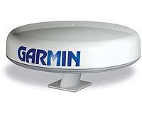
Garmin International, a unit of Garmin, Tuesday announced the much-anticipated debut of the GMR 20 and GMR 40, two powerful marine radar scanners for use with the Garmin Marine Network. "The introduction of these two radar units further establishes the Garmin Marine Network as an innovative and technologically advanced navigation system," said Gary Kelley, Garmin's director of marketing. "The GMR 20 and GMR 40 add important radar information to a system that already includes GPS, sonar, and XM WX Satellite Weather data components - making the Marine Network one of the most comprehensive marine navigation systems on the market. These products allow boaters to be more confident, more productive, and have a more enjoyable time on the water." The GMR 20 (2kW radome) and the GMR 40 (4kW radome) feature a narrow 3.6-degree horizontal and 25-degree vertical beamwidth, which allow for accurate target acquisition and better penetration through rain and fog. The GMR 20 has a range of 24 nautical miles (nm), while the GMR 40 extends to 36nm. For fast and efficient presentation of radar signatures, raw data is processed within the radome and presented on Garmin's GPSMAP 3006C and GPSMAP 3010C chartplotter/multifunction displays (MFDs). Once the GMR 20 or 40 are interfaced with a GPSMAP 3006C or 3010C, it is possible to overlay radar images on the charting - to help reconcile radar signatures with known objects on the Marine Network's GPS-enabled chartplotter. Users can also configure a split-screen, dual overlay with a standard radar presentation. To aid in collision avoidance, the units also offer MARPA (Mini Automatic Radar Plotting Aid) capability, which allow boaters to track the bearing, course, speed and predicted closest approach (by both time and distance) of up to 10 targets. MARPA functionality requires GPSMAP 3006C or 3010C series MFD and an optional heading sensor. The GMR 20 and 40 feature automatic and manual sensitivity and tuning controls, including gain, sea clutter, and rain clutter - which allows boaters to spend less time tuning the unit and more time navigating. The units also boast selectable interference rejection, which mitigates the effect of nearby radar transmissions. The GMR 20 and GMR 40 communicate with the Garmin Marine Network through a waterproof 100-megabit plug-and-play proprietary network - which affords users the ability to expand their boat's system as needed. Boaters can connect a GPS antenna and one remote network sensor (like the GMR 20/40) directly to the MFD - or with the addition of the GMS 10 Network Port Expander, users can connect multiple MFDs and network sensors to the same network. Combined with Garmin's unique GDL 30/30A, mariners can access near real-time graphical weather data and audio channels directly on the GPSMAP 3010C or 3006C through a subscription to XM WX Satellite Weather data service and XM Radio. Coverage extends several hundred miles off the shores of the continental U.S. The Garmin Marine Network can also receive sonar data through an MFD connected to the GSD 20, Garmin's proprietary "black box" sounder, which offers 4,000 watts of power peak-to-peak (500 watts RMS) in a dual-frequency transducer. The GMR 20 and GMR 40 are expected to be available in December 2004. The GMR 20 has a suggested retail price of $1919.99, and the GMR 40 has an MSRP of $2346.66. Related Links Garmin SpaceDaily Search SpaceDaily Subscribe To SpaceDaily Express  Richmond BC (SPX) Oct 15, 2004
MacDonald, Dettwiler and Associates announced Thursday that the government of Finland is extending its use of RADARSAT-1 information and has signed a pre-launch commitment for RADARSAT-2 information.
|
| ||||||||||
| The content herein, unless otherwise known to be public domain, are Copyright 1995-2016 - Space Media Network. All websites are published in Australia and are solely subject to Australian law and governed by Fair Use principals for news reporting and research purposes. AFP, UPI and IANS news wire stories are copyright Agence France-Presse, United Press International and Indo-Asia News Service. ESA news reports are copyright European Space Agency. All NASA sourced material is public domain. Additional copyrights may apply in whole or part to other bona fide parties. Advertising does not imply endorsement, agreement or approval of any opinions, statements or information provided by Space Media Network on any Web page published or hosted by Space Media Network. Privacy Statement All images and articles appearing on Space Media Network have been edited or digitally altered in some way. Any requests to remove copyright material will be acted upon in a timely and appropriate manner. Any attempt to extort money from Space Media Network will be ignored and reported to Australian Law Enforcement Agencies as a potential case of financial fraud involving the use of a telephonic carriage device or postal service. |