| . |  |
. |
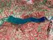 Lexington - May 19, 1999 - Raytheon Company is now receiving, archiving and distributing data from the NASA's recently launched Landsat-7 satellite. Landsat-7 is the latest phase of NASA's 15-year Earth Observing Systems program of integrated studies of the earth from space.
This launch is the first mission supported by the Earth Observing System Data and Information System (EOSDIS) Core System (ECS) developed by Raytheon. The Raytheon ground system will receive and archive calibrated imagery data from the Landsat-7 processing system and distribute the data to users worldwide. This system will enhance NASA's ability to gather and utilize enormous amounts of new data about the earth's surface conditions. When fully operational, Landsat-7 and its sister satellites will feed data into what will be one of the largest non-military databases in the world. Orbiting approximately 438 miles above the earth, Landsat-7 will gather images in the visible and infrared portions of the spectrum in a swath some 115 miles wide to supplement global change research and to enable other potential regional and commercial applications. "The successful launch of Landsat-7 is an important event because it is the first mission to be supported by the EOSDIS Core System, and because it is an important mission within NASA's Earth Science Enterprise," said Dolly Perkins, deputy associate director of flight projects for NASA's EOS operations. "Landsat-7 will provide rich new data for science and applications users. Users will search and order the data over the World Wide Web. On the backend of this, ECS provides all archive and distribution services, Perkins added." The Raytheon-developed ECS will support Landsat-7, and the Terra satellite, to be launched in July of this year, and at least half a dozen other satellites in the NASA Earth Science Enterprise program. ECS serves as a universal ground system that allows for multiple mission support and enables new instrument data types and processing algorithms to be easily interchangeable, further enhancing the program and extending the program life cycle. The data will be archived and available via the internet to educators, scientists and other interested parties. Raytheon is the prime contractor for NASA's EOSDIS Core System. Subcontractors on the program include Lockheed-Martin, Electronic Data Systems, Science Applications Corporation, NYMA, Inc., and EOS-L. The Raytheon work is being done at its facility in Upper Marlboro, Maryland.
Earth Observation Reports At SpaceDaily
|
| |||||||||
| The content herein, unless otherwise known to be public domain, are Copyright 1995-2016 - Space Media Network. All websites are published in Australia and are solely subject to Australian law and governed by Fair Use principals for news reporting and research purposes. AFP, UPI and IANS news wire stories are copyright Agence France-Presse, United Press International and Indo-Asia News Service. ESA news reports are copyright European Space Agency. All NASA sourced material is public domain. Additional copyrights may apply in whole or part to other bona fide parties. Advertising does not imply endorsement, agreement or approval of any opinions, statements or information provided by Space Media Network on any Web page published or hosted by Space Media Network. Privacy Statement All images and articles appearing on Space Media Network have been edited or digitally altered in some way. Any requests to remove copyright material will be acted upon in a timely and appropriate manner. Any attempt to extort money from Space Media Network will be ignored and reported to Australian Law Enforcement Agencies as a potential case of financial fraud involving the use of a telephonic carriage device or postal service. |