| . |  |
. |
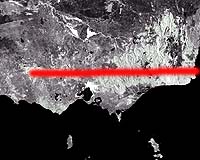
A team of earth scientists is planning to slice the State of Victoria clean in half ďż˝ for its own ultimate good. Over the next two years they intend to 'carve' a 500 kilometre swathe across the Victorian landscape through the Grampians, Bendigo, Benalla, Wodonga, curving down to Mallacoota on the coast. Using seismology and drill cores, they will 'peel' back the surface layers to disclose an eerie, hidden landscape of undiscovered gold and mineral wealth, buried hills, valleys and fossil streams, giant extinct volcanoes and lurking environmental timebombs like salinity and dormant volcanoes. The Victorian geotraverse is the largest project of its kind in Australian history ďż˝ a full-scale attempt to probe into the titanic processes that shaped today's Victoria and formed the wealth that has powered its economic and social prosperity for almost two centuries. It is also a vast test-bed for the technologies that will make the next generation of mineral discoveries across Australia, and pioneer the first generation of sophisticated environmental management and landscape-scale sustainable systems. Twelve top earth science bodies plan to join hands with local and State government, industry and communities, to unlock hidden wealth, head off land degradation, create new regional jobs, industries and opportunities. They include the Victorian Department of Natural Resources and Environment, Geoscience Australia and the Co-operative Research Centre Landscape Environments and Mineral Exploration, and CSIRO. "We won't actually cut the state in half, but we will take an imaginary cross-section of it and explore that in detail and in depth, to figure out things like where the rest of the gold deposits are or where the next salinity disaster might strike," explains CSIRO's Professor Neil Phillips, who is leading the project. Victoria's famous rush contributed 2500 tonnes of gold ďż˝ 2 per cent of all the gold ever mined in human history. But the chances are that less than a third of what was actually there has so far been dug up. Another 5000 tonnes may lie in hills and valleys, themselves concealed hundreds of metres beneath the flat and featureless sweep of the Murray river plains, like a chain of undersea mountains. The story of Victoria' wealth begins some 400 million years ago, when 20 giant volcanoes ďż˝ several of the scale of a Mount St Helens ďż˝ blew their stack and carpeted the landscape in roiling pyroclastic cascades, flowing basalt and deep beds of ash. Hills rose, the earth folded, rivers flowed and were buried. From this period of fume and fury ďż˝ the hottest, most violent episode in Victoria's 600 million year history, says Prof Phillips ďż˝ was also laid down wealth of the future: the gold that later enriched the people who came to live here, and the hills that slowly weathered into the bountiful soils of the Murray plain, sustaining Australia's most valuable agricultural region. "It all happened in about 50 million years ďż˝ and there's been nothing like it since, although there has been some milder volcanic activity over the last 5 million years in the western part of the State," he says, adding, "that's still not over, either. The last event was 7000 years ago." "The hills that contain Victoria's gold-bearing quartz are 400 million years old. That enormous rock mass then tilted. From the south and center of the State, it plunges beneath the flat surface of the Murray plain ďż˝ and we've every reason to believe that the gold they contain extends there too. Perhaps two thirds of it still lies underground, beyond our sight or powers of detection till now." Salinity, till recently, was largely seen as a two-dimensional threat ďż˝ a menace which just happened on the surface, or close to it. By peering underground using cutting-edge airborne survey tools like TEMPEST, scientists are starting to spot large 'pods' of saline water with potential to burst out onto the surface if handled wrongly, with lethal consequences for farms, rivers and native bush. Also they have 'unearthed' a complex network of buried rivers and drainage channels, sometimes running in completely different directions to those on the surface. "This means, for example, that if you planted trees to stop water running down a hill slope into a saline soak below, you could still get it wrong if the salt is actually flowing in from somewhere quite different in the landscape along one of these buried palaeo-channels," Prof Phillips said. "We need to be able to see the landscape in four dimensions ďż˝ including depth and time ďż˝ if we are to truly understand how it functions, and what we need to do to protect our agriculture and our environment." Prof Phillips says the Victorian geotraverse is unique in the way it brings together scientists from a wide range of disciplines to gain an unrivalled understanding of how a landscape formed long ago, how it works today ďż˝ and what we can and can't safely do within it. The experiment will also be used to test CSIRO's famous Glass Earth technology ďż˝ a combination of advanced sensing technologies able to "see" into the landscape to a depth of a kilometre or more. This technology is expected to become the mineral prospecting tool of choice for Australia ďż˝ and potentially the world ďż˝ over the coming decade. The project will be presented at a geology conference, Victoria Undercover, being held in Benalla, Victoria 30 April ďż˝ 2 May, 2002. Related Links CSIRO Exploration and Mining SpaceDaily Search SpaceDaily Subscribe To SpaceDaily Express  Albuquerque - Apr 22, 2002
The effort to create a National Underground Science Laboratory received a major endorsement during the weekend from the National Research Council's Committee on the Physics of the Universe.
|
| ||||||||||
| The content herein, unless otherwise known to be public domain, are Copyright 1995-2016 - Space Media Network. All websites are published in Australia and are solely subject to Australian law and governed by Fair Use principals for news reporting and research purposes. AFP, UPI and IANS news wire stories are copyright Agence France-Presse, United Press International and Indo-Asia News Service. ESA news reports are copyright European Space Agency. All NASA sourced material is public domain. Additional copyrights may apply in whole or part to other bona fide parties. Advertising does not imply endorsement, agreement or approval of any opinions, statements or information provided by Space Media Network on any Web page published or hosted by Space Media Network. Privacy Statement All images and articles appearing on Space Media Network have been edited or digitally altered in some way. Any requests to remove copyright material will be acted upon in a timely and appropriate manner. Any attempt to extort money from Space Media Network will be ignored and reported to Australian Law Enforcement Agencies as a potential case of financial fraud involving the use of a telephonic carriage device or postal service. |