| . |  |
. |
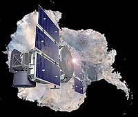
NASA's Ice, Cloud and land Elevation Satellite (ICESat) has resumed measurements of the Earth's polar ice sheets, clouds, mountains and forests with the second of its three lasers. Crisscrossing the globe at nearly 17,000 miles per hour, this new space mission is providing data with unprecedented accuracy on the critical third dimension of the Earth, its vertical characteristics. "The first set of laser measurements is revealing features of the polar ice sheets with details never seen before, and is detecting dust storms, cloud heights, tree heights and smoke from forest fires in new and exciting ways," said Jay Zwally, ICESat Project Scientist at NASA's Goddard Space Flight Center, Greenbelt, Md. The principal mission of ICESat is to measure the surface elevation of the large ice sheets covering Antarctica and Greenland. Measurements of elevation-change over time will show whether the ice sheets are melting or growing as the Earth's climate undergoes natural and human-induced changes. The Geoscience Laser Altimeter System (GLAS) instrument on ICESat sends short pulses of green and infrared light though the sky 40 times a second, all over the globe, and collects the reflected laser light in a one-meter telescope. The elevation of the Earth's surface and the heights of clouds and aerosols in the atmosphere are calculated from both precise measurements of the travel time of the laser pulses, and ancillary measurements of the satellite's orbit and instrument orientation. This marks the first time any satellite has made vertical measurements of the Earth through the use of an onboard light source. Operating in a near-polar orbit, ICESat is adding to our understanding of the mass-balance of the Greenland and Antarctic ice sheets. ICESat's first topographic profiles across Antarctica revealed details of features such as the ice streams of the Siple Coast and the Amery Ice Shelf, as well as the atmospheric phenomena above them. ICESat is also making unique measurements of cloud heights and global distribution. ICESat detects distributions of aerosols from sources such as dust storms and forest fires. And because its laser pulses continuously, ICESat also measures the Earth's topography with high accuracy. "ICESat has already demonstrated the unique capability of lasers to make a variety of Earth Science measurements. When the calibration experiments are completed, we believe the accuracy and sensitivity will exceed previous capabilities by nearly an order of magnitude," stated Bob Schutz, GLAS Science Team Leader, of the University of Texas at Austin. ICESat was launched January 12, 2003, on a Boeing Delta II rocket from Vandenberg Air Force Base, Calif. On March 29, ICESat's Laser 1 unexpectedly stopped working after providing 36 days of data. NASA will issue a report shortly on the reason for the anomaly. "Despite the problem with the first laser, ICESat is providing a new perspective on elements within the Earth System with amazing accuracy. We are especially looking forward to the information this capability will provide on how the polar ice sheets are changing," said Waleed Abdalati, ICESat Program Scientist at NASA Headquarters, Washington. The ICESat scientists will convene a special session to present the latest results from ICESat at the 2003 Fall Meeting of the American Geophysical Union in San Francisco. ICESat is the latest in a series of NASA's Earth observation spacecraft designed to study the environment of our home planet and how it may be changing. NASA's Earth Science Enterprise is dedicated to understanding the Earth as an integrated system and applying Earth System Science to improve prediction of climate, weather and natural hazards using the unique vantage point of space. Related Links ICESat SpaceDaily Search SpaceDaily Subscribe To SpaceDaily Express  Greenbelt - Oct 02, 2003
NASA satellites have observed the calving, or breaking off, of one of the largest icebergs ever recorded. Named "C-19" - the iceberg separated from the western face of the Ross Ice Shelf in Antarctica in May 2002, splashed into the Ross Sea, and virtually eliminated a valuable food source for marine life. The event was unusual, because it was the second-largest iceberg to calve in the region in 26 months.
|
| ||||||||||
| The content herein, unless otherwise known to be public domain, are Copyright 1995-2016 - Space Media Network. All websites are published in Australia and are solely subject to Australian law and governed by Fair Use principals for news reporting and research purposes. AFP, UPI and IANS news wire stories are copyright Agence France-Presse, United Press International and Indo-Asia News Service. ESA news reports are copyright European Space Agency. All NASA sourced material is public domain. Additional copyrights may apply in whole or part to other bona fide parties. Advertising does not imply endorsement, agreement or approval of any opinions, statements or information provided by Space Media Network on any Web page published or hosted by Space Media Network. Privacy Statement All images and articles appearing on Space Media Network have been edited or digitally altered in some way. Any requests to remove copyright material will be acted upon in a timely and appropriate manner. Any attempt to extort money from Space Media Network will be ignored and reported to Australian Law Enforcement Agencies as a potential case of financial fraud involving the use of a telephonic carriage device or postal service. |