| . |  |
. |
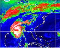
Boston MA (SPX) Aug 10, 2004 AIR Worldwide Corporation (AIR) Monday announced the release of its 2004 US hurricane, earthquake, severe thunderstorm and terrorism models. The updated models reflect the latest scientific and engineering research into these perils, as well as data on recent events, including last spring's record-breaking severe thunderstorm outbreak. Specific enhancements include a new approach to estimating the vulnerability of commercial structures to wind. AIR has also updated estimates of seismic hazard in the Central United States based on the most recent report from the USGS and estimates of the frequency and severity of potential terrorist attacks. The 2004 updates also include, for users of AIR's CATRADER software, a refined database of residential and commercial properties in the United States. "The 2004 release represents the culmination of a significant research and development effort conducted over the course of the last year," said Dr. Jayanta Guin, AIR's vice president of research and modeling. "Our annual update process ensures that clients, who rely on the AIR models for critical underwriting, pricing and reinsurance decisions, have timely access to the latest research findings." Key enhancements to AIR's models are as follows:
The damage functions, which are used to generate loss estimates, now explicitly account for building height, a variety of building envelope characteristics, and repair costs, in addition to occupancy and construction type. The model also incorporates an updated historical storm set that includes all landfalling and bypassing hurricanes through 2002.
AIR has also updated its hail damage functions for automobiles to account for the fact that hailstorms typically occur in the late afternoon, during peak commuting hours, when exposure is high. US Terrorism Model - The 2004 terrorism model incorporates the latest threat assessments from AIR's external team of terrorism and counter-terrorism experts. The panel determined that there is an increased threat to softer, but still high-value targets, such as transportation facilities and prominent commercial buildings, and a lowered threat to well-protected sites, such as federal facilities and nuclear plants. AIR's comprehensive landmark database has also been updated, including newly identified "trophy" targets. The 2004 release also includes a newly enhanced database of industrywide property values, which is incorporated into AIR's CATRADER software. The new procedure for estimating property values is based on highly detailed information, including construction and square foot estimates for both residential and commercial properties. The data set draws information from AIR's new residential replacement valuation tool, ISO HomeValue, and ISO's extensive SPI database of commercial properties.
AIR Worldwide SpaceDaily Search SpaceDaily Subscribe To SpaceDaily Express
 Tombstone AZ (SPX) Aug 09, 2004
Tombstone, Arizona, is a dusty place known for Wyatt Earp's famous 1881 "Gunfight at the O.K. Corral." This year, from August 2 to 27, it will be known as the place where scientists from NASA, the US Department of Agriculture (USDA), the National Oceanic and Atmospheric Administration (NOAA), and other institutions gather and study soil moisture to improve weather forecasts and the ability to interpret satellite data. |
|
| The content herein, unless otherwise known to be public domain, are Copyright 1995-2006 - SpaceDaily.AFP and UPI Wire Stories are copyright Agence France-Presse and United Press International. ESA PortalReports are copyright European Space Agency. All NASA sourced material is public domain. Additionalcopyrights may apply in whole or part to other bona fide parties. Advertising does not imply endorsement,agreement or approval of any opinions, statements or information provided by SpaceDaily on any Web page published or hosted by SpaceDaily. Privacy Statement |