| . |  |
. |
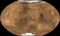
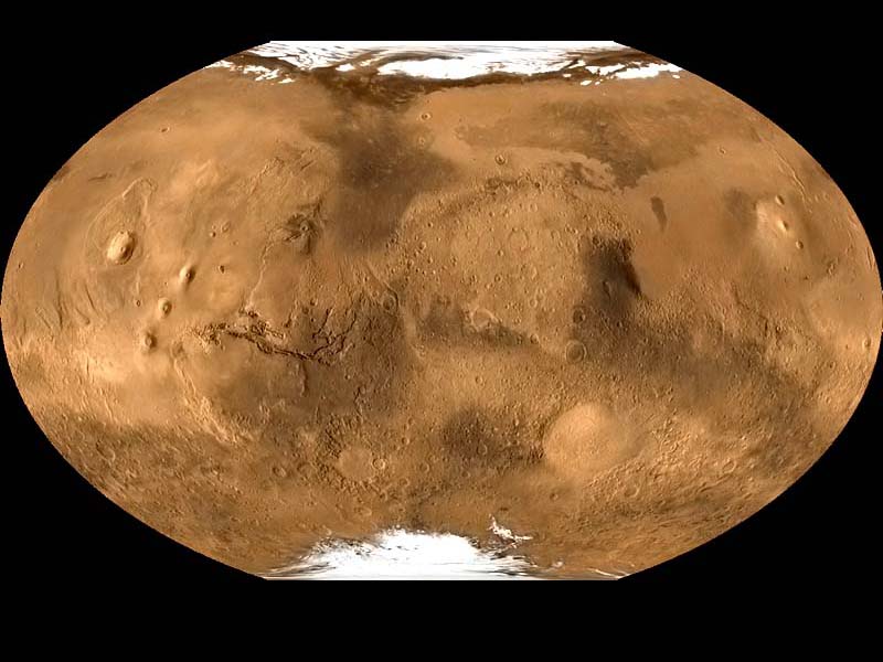
Cameron Park - May 8, 2001 The similarities between the valley networks of Mars and our own river networks here on Earth are biggest single element in the White Mars Theory that its leading proponents acknowledge as being the most uncertain. Nonetheless, several possible explanations for the valley networks have been proposed that don't require water. One is that they actually may have been produced by a smaller, gentler version of cryoclastic gas eruptions -- if such a gas jet erupted at moderate intensity for a long period, it might carve a slowly but steadily lengthening narrow channel that would meander along sloping landscapes in the same way as a flow of liquid. Hoffman claims that some narrow, meandering channels plowed along undersea sediment slopes on Earth for hundreds of km by "turbidity currents" -- underwater avalanche-like flows of sediment mixed with water, rather like a watery version of cryoclastic clouds -- do rather closely resemble the Martian valley networks, and J.D. Parsons agreed with him in a new LPSC abstract. But there are some doubts as to whether these channels are really narrow and winding enough to fill the bill -- and, besides, liquid currents obviously do have much different physical characteristics than gas currents. Another possibility is that Mars' valley networks were indeed "sapped out" by gradual underground flows of liquid -- but the liquid was not water but CO2, which (as I noted) is under enough pressure to stay liquid today if it's under as little as 7 meters of ground, provided it's sealed off from direct exposure to the surface by a layer of ground ice or nonporous rock. In that case, though, the explosive eruption of the liquid into gas when the roof finally did cave in on one part of the sapped-out underground tunnel might leave surface marks of a type that haven't been seen. And, besides, the formation of the valley networks trailed off in the Hesperian Era at the same time that the great catastrophic outflows were still occurring -- something you wouldn't expect to happen if the networks had also been formed by underground liquid CO2. Hoffman has proposed one other possible alternative theory that might get around these problems. In the Noachian Age, Mars was still undergoing "heavy bombardment" by frequent giant asteroid impacts that gouged out craters 100 km and more across. (Noachian Mars may have been a nice place for microbes, but it would have been a very unhealthy one for any advanced form of life.) He thinks that the blast of heat and shock from each of these impacts would have instantly vaporized enough of the planet's frozen CO2 to give it an "ephemeral dense atmosphere" that might have a surface pressure of as much as several bars, but which would last only a few decades before refreezing. During this period, Mars could have had an air pressure high enough -- and warmth enough from the impact itself and from the new dense air's greenhouse effect -- for liquid water to flow briefly along the surface or near-surface, at least in the warm area near the impact itself. If its air pressure was over 5 bars during these periods, it might even have had rains of liquid CO2 -- and warm water raining onto frozen Martian ground that was glued together mainly by permafrost would be very efficient at eroding surface features, which he thinks might explain the high overall level of Noachian surface erosion. Then, after the short interlude, Mars would have refrozen and its atmosphere would have vanished until the next impact. But even if these brief "ephemeral" periods occurred often enough to explain the amount of erosion that went on in the Noachian, there's another problem. Most planetary atmospheric scientists think that, while Noachian Mars may very well have been too cold for liquid water to exist on its surface, it was definitely NOT so cold that CO2 would freeze out on it -- for, if a dense CO2 atmosphere ever managed to get started there at all (either from Mars' initial warmth after its formation, or from a giant impact or volcanic outburst), such an atmosphere would definitely generate more than enough greenhouse warming to at least keep itself from getting anywhere near refreezing again. It would be around for keeps -- at least until it was destroyed over hundreds of millions of years by carbonate formation, being blasted into space by meteor impacts, or being slowly swept away from Mars by the solar wind. It may be that Noachian Mars actually was warm enough for liquid water to flow across or just under its surface in some areas -- or, if its air pressure was high enough, for rains and rivers of liquid CO2 to exist on its surface (maybe even at the same time as the underground liquid water!) -- and then, as the planet lost some of its dense CO2 air and its internal geothermal heat died down, it actually got colder despite the growing heat of the Sun and its remaining CO2 atmosphere condensed back down into the subsurface (Hoffman and Jeffrey Kargel have proposed several mechanisms by which this might occur). Then, later on, as the Sun started somewhat warming up the planet again in the late Hesperian, some of the buried liquid CO2 might have burst forth violently from underground yet again to blast out the catastrophic-outflow channels, eventually freezing out again on or near the surface as clathrate ice or genuine frozen CO2 in Mars' polar caps. At any rate, Hoffman's theory has undeniably set the cat among the pigeons where theorizing about the history of Mars is concerned -- and so every scientific clue our spacecraft have provided so far about the planet is being inspected doubly intensely. And just in the past year, MGS' super-detailed telephoto pictures of Mars' surface -- frequently showing details as little as 2 meters across -- have provided two spectacular new revelations which were the subject of great debate at the LPSC. The first is solid confirmation of something suspected for several years: in Mars' equatorial regions, there are large areas where the planet's ancient surface includes dozens -- and sometimes hundreds -- of distinct layers of sedimentary rock. These layers were apparently laid down during the Noachian (and perhaps the later Hesperian) Era, and since then have been partly reexposed by wind erosion. They seem to have been mostly laid down in ancient depressions on the planet: some impact craters, the gently sloping lower floors of the branching canyons linked to the Marineris Valley, and the central plain in the Meridiani Highlands (where they have been patchily reexposed, producing a gently undulating surface). Obviously these layers might have been laid down as sediment on the floors of bodies of standing water, in separate episodes where such water accumulated, then disappeared, and then later returned to lay down another layer on top of the previously cemented rock layer -- a cheery picture where the habitability of early Mars is concerned. For this reason, they are definitely the favored landing areas for the two rovers which the U.S. plans to send to Mars in 2003 -- it's a safe bet that one of them will be landed on the Meridiani plain, where one rock layer seems to have been composed of water-deposited hematite, and there's a good chance that the other one will be landed in another layered area on the floor of a crater or one of the Marineris canyons. But there's a puzzle: most of the craters floored with this material don't seem to have fluid drainage channels running into them. So there is also the possibility that they were laid down in the depressions as airborne dust or sand, which was then slowly cemented into rock over millions of years by surface chemical processes perhaps involving only tiny traces of soil water before the next episode in which another layer of airborne sediment was laid down. The layered material seems to be spread too widely for it to have been just been strewn by local giant crater impacts. Another possibility is that it might be ash ejected from volcanic eruptions -- a theory which M.G. Chapman and Laszlo Keszthelyi set forth at the Conference. Chapman thinks that ash may have been violently ejected from many regions where rising hot magma encountered patches of ground ice to produce steam explosions; Kesthelyi thinks that exposure to water may not even have been necessary if the eruptions occurred during the Hesperian, because Mars' low air pressure by then would have caused the other gases stored in the lava to expand more violently on ejection. Again, however, it may be that the layered material is spread too widely for such volcanic eruptions alone to account for it, which raises another possibility: each layer may have been laid down during a period in which Mars' overall air pressure rose sharply, allowing windblown material to be much more easily carried -- after which the air pressure then dropped again until another episode when the next layer of dust was laid down. M.I. Richardson and Daniel McCleese reported an analysis indicating that an air pressure increase of only about fivefold above Mars' current wispy pressure could do this -- and that, as Mars' spin-axis tilt slowly increases and decreases over cycles of hundreds of thousands of years, such wind patterns would change enough to explain the fact that winds in some eras laid down material in some regions which later winds eroded it again to expose the layering. What could have caused early Mars' air pressure to hop up and down so sharply? That same changing tilt of its spin axis is one explanation, but might not have produced changes big enough. Nick Hoffman himself explains it by saying (as I've noted before) that any giant meteor impact during the Noachian Age -- when he thinks Mars was usually frozen solid and had almost no air -- would have released a tremendous blast of thawed-out CO2 and water to produce an "ephemeral" dense and warm atmosphere on the planet for several decades or even thousands of years, during which airborne dust kicked up by the impact and rain from melted ice would have fallen onto the surface until the atmosphere refroze and cemented the new sediment layer in place with ice. Indeed, one need not share his belief that early Mars' atmosphere was usually very thin to agree with this theory -- even if Noachian Mars had a dense atmosphere, any such impact would have vaporized the ground ice in a vast area, sharply warmed up the planet in general for a short time, somewhat increased its air pressure, and thus produced strong new winds that would have blown the blasted-out sediment for vast distances. One side element of this debate is the question of what caused the lower-level layering in the canyons of the Marineris Valley, and when. There's general agreement that most of the dramatic layering visible in the walls of the Valley (extending as high as 8 km) is due to lava flows being laid down repeatedly by the Tharsis Bulge's spectacular volcanic history. M.E. Purucker said at the Conference that some of the broad north-south "stripe zones" of magnetized material discovered on Mars by MGS seem to jerk 150-300 km to the east where they cross they cross the Valley -- the first strong evidence that there were once "strike-slip" faults running along the Valley so that the plates of Martian crust to its north and south could slide past each other on an east-west line during the planet's early days to produce earthquakes. He also noted that one such magnetized northern stripe seems to simply stop where it touches the Valley, suggesting that the buried layer of ancient magnetized lava rock on Mars may be exposed to the open air by the great Valley cliffs at that point and could be sampled there by future expeditions. But there is an entirely different set of narrower layers visible along the bottom edges of those cliffs, extending along the gently sloping canyon floors, and forming mesas sticking up as high as 5 km from those floors. These are made up of much softer rock, which (as Paul Caruso pointed out in an LPSC paper) can't seem to maintain a slope sharper than 30 degrees without landslides, pretty much confirming that they are made of sandstone or shale. Michael Malin and Kenneth Edgett, in their important December 2000 "Science" paper describing Mars' sedimentary layering, suggested that these layers are extremely old -- laid down during the Noachian Era, covered over by the repeated lava flows from the great Tharsis shield volcanoes, and later exposed as a cross-section when the Marineris Valley was split open by tectonic forces as the Tharsis Bulge rose higher. However, at the Conference B.K. Lucchitta and Paul Weitz said that the tilt of these sedimentary layers, where they lap up against the foot of the igneous cliffs, is different from the tilt of the lava-flow layers, and that in some places they lap over ancient, more heavily landslide deposits on the canyon floors, strongly indicating that they were laid down on the floor of the Valley AFTER its formation in the mid-Hesperian. This could indicate -- as Lucchitta says -- that they are sediment laid down on the floors of great lakes several km deep that filled the Valley's canyons for a while after its formation, "implying that a relatively wet episode occurred at least as late as Martian mid-history." Many theorists think so, and Christopher McKay has pointed out that such ice-covered lakes could have stayed mostly liquid for hundreds of millions of years after the rest of Mars had lost almost all its atmosphere and dropped below freezing, providing a later-period shelter for ancient Martian life. But ARE they water-deposited sediments, or airborne ones laid down during repeated very brief episodes of dense Martian air produced by giant impacts? We just don't know yet. John F. Mustard -- examining near-IR spectra of the deposits taken by the short-lived Russian "Phobos 2" Mars orbiter in 1988 -- found some tentative signs that they might be made of water-deposited sediment; and Weitz said that the sedimentary deposits have narrow channels running down their flanks that seem to have been carved by running water rather than winds, perhaps during a period when part of the water in the canyon lakes drained off into the Chryse lowlands. But this is nowhere near conclusive.
|
| ||||||||||
| The content herein, unless otherwise known to be public domain, are Copyright 1995-2016 - Space Media Network. All websites are published in Australia and are solely subject to Australian law and governed by Fair Use principals for news reporting and research purposes. AFP, UPI and IANS news wire stories are copyright Agence France-Presse, United Press International and Indo-Asia News Service. ESA news reports are copyright European Space Agency. All NASA sourced material is public domain. Additional copyrights may apply in whole or part to other bona fide parties. Advertising does not imply endorsement, agreement or approval of any opinions, statements or information provided by Space Media Network on any Web page published or hosted by Space Media Network. Privacy Statement All images and articles appearing on Space Media Network have been edited or digitally altered in some way. Any requests to remove copyright material will be acted upon in a timely and appropriate manner. Any attempt to extort money from Space Media Network will be ignored and reported to Australian Law Enforcement Agencies as a potential case of financial fraud involving the use of a telephonic carriage device or postal service. |