| . |  |
. |
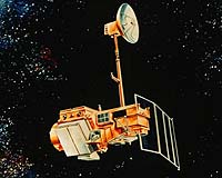
On November 26, 2005, the back-up solar array drive on Landsat 5 began exhibiting unusual behavior. The solar array drive maintains the proper pointing angle between the solar array and the sun, but its rotation has become became sporadic, and the solar array is currently unable to provide the power needed to charge the batteries. Maintaining power to the batteries is critical to sustain proper operation of the spacecraft and the primary solar array drive failed under similar circumstances last January. As a result of this current situation, imaging operations will be suspended for at least the next two weeks, or until attempts to solve the problem have been resolved. Landsat 5, launched in March 1984, has performed far beyond its three-year design lifetime and has continued to collect global land surface coverage. Over 125,000 images, from the Chernobyl disaster to Hurricane Katrina, have proven invaluable for identifying the impact of natural and human-induced changes. Landsat 5 and Landsat 7, together, have been providing full global coverage of the Earth's surface every eight days. The Landsat Program is the longest running program providing vital images of the Earth's surface from space. The first Landsat satellite was launched in 1972. In 1999, the Landsat Program took a giant technological leap forward with the launch of Landsat 7. The Landsat Program is a joint initiative of USGS and NASA to gather Earth resource data using a series of satellites including Landsats 5 and 7. NASA is responsible for developing and launching the spacecrafts, while the USGS is responsible for flight operations, maintenance, and management of all data reception, processing, archiving, product generation, and distribution. The primary objective of the Landsat Program is to ensure a consistent, calibrated collection of Earth imagery that can be used to scientifically measure change over decades and beyond. Related Links SpaceDaily Search SpaceDaily Subscribe To SpaceDaily Express  Greenbelt MD (SPX) Sep 14, 2005
The Amazon, a vast tropical forest stretching across South America, is so large that is virtually impossible to study the evolving landscapes within the basin without the use of satellites.
|
| ||||||||||
| The content herein, unless otherwise known to be public domain, are Copyright 1995-2016 - Space Media Network. All websites are published in Australia and are solely subject to Australian law and governed by Fair Use principals for news reporting and research purposes. AFP, UPI and IANS news wire stories are copyright Agence France-Presse, United Press International and Indo-Asia News Service. ESA news reports are copyright European Space Agency. All NASA sourced material is public domain. Additional copyrights may apply in whole or part to other bona fide parties. Advertising does not imply endorsement, agreement or approval of any opinions, statements or information provided by Space Media Network on any Web page published or hosted by Space Media Network. Privacy Statement All images and articles appearing on Space Media Network have been edited or digitally altered in some way. Any requests to remove copyright material will be acted upon in a timely and appropriate manner. Any attempt to extort money from Space Media Network will be ignored and reported to Australian Law Enforcement Agencies as a potential case of financial fraud involving the use of a telephonic carriage device or postal service. |