| . |  |
. |
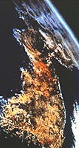
South Korea will embark on a plan this month to develop a maritime observation satellite capable of providing data on waters surrounding the Korean Peninsula, reported South Korean Yonhap News Agency on Tuesday. The envisioned geostationary satellite will be jointly designed and constructed by the Korea Aerospace Research Institute, the Korea Ocean Research and Development Institute and Astrium, a French satellite maker, Yonhap quoted the South Korean Ministry of Maritime Affairs and Fisheries as reporting. The report said the satellite would be placed in a geostationary orbit over the equator. However, it did not disclose when the satellite would be completed or launched. The proposed satellite's would cover a 2,500-by-2,500 kilometer footprint surrounding South Korea and parts of the South China Sea, said Yonhap. The satellite would provide maritime information on an hourly basis, unlike the daily or weekly information that the country is currently receiving from foreign commercial satellites. The satellite would also help policymakers and disaster relief organizations have a clearer understanding of developments such asyellow dusts, forest fires and snowstorms, added Yonhap. The satellite could also be used to determine the occurrence of red tide, an overgrowth of toxic algae which usually occurs off South Korean south coast during summer. Related Links Korea Aerospace Research Institute SpaceDaily Search SpaceDaily Subscribe To SpaceDaily Express 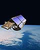 Paris (ESA) Apr 19, 2005
The northernmost part of the Baltic Sea, between Finland and Sweden, recently provided an ideal location for scientists to successfully address critical issues relating to sea ice validation before CryoSat is launched in September.
|
| ||||||||||
| The content herein, unless otherwise known to be public domain, are Copyright 1995-2016 - Space Media Network. All websites are published in Australia and are solely subject to Australian law and governed by Fair Use principals for news reporting and research purposes. AFP, UPI and IANS news wire stories are copyright Agence France-Presse, United Press International and Indo-Asia News Service. ESA news reports are copyright European Space Agency. All NASA sourced material is public domain. Additional copyrights may apply in whole or part to other bona fide parties. Advertising does not imply endorsement, agreement or approval of any opinions, statements or information provided by Space Media Network on any Web page published or hosted by Space Media Network. Privacy Statement All images and articles appearing on Space Media Network have been edited or digitally altered in some way. Any requests to remove copyright material will be acted upon in a timely and appropriate manner. Any attempt to extort money from Space Media Network will be ignored and reported to Australian Law Enforcement Agencies as a potential case of financial fraud involving the use of a telephonic carriage device or postal service. |