|
Free Newsletters - Space News - Defense Alert - Environment Report - Energy Monitor |
| . |  |
. |
|
|
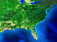
Future NOAA Spacecraft Will Improve Management Of America's Coastal Waters
During a recent meeting in Corvallis, Ore., scientists from the National Oceanic and Atmospheric Administration, NASA, the Office of Naval Research and academia discussed using data from a highly advanced imaging device - set to go onboard the next generation of Geostationary Operational Environmental Satellites (GOES-R) - to track red tides, oil spills, upwelling and other U.S. coastal water management issues more effectively. The device, called the Hyperspectral Environment Suite, will be a major imaging instrument on the GOES-R spacecraft, which is scheduled to launch in 2012. HES will include a capability to image all U.S. coastal waters and is expected to provide critical data to resource managers and researchers studying climate, fisheries, coastal ecology and oceanography. The scientists are part of the Coastal Ocean Applications and Science Team, which is a new effort to ensure that GOES-R data meet stringent research and application criteria to better monitor and study coastal waters. "NOAA is working with other government agencies, academia and the private sector in efforts to build an integrated ocean observing system, a shared collection of data that the U.S. Commission on Ocean Policy strongly recommends as a critical step in improving ocean and coastal resource management," said Richard W. Spinrad, assistant administrator of NOAA's National Ocean Service. "Having the type of detailed data that the HES imaging instrument can provide is a critical component of building such a system." "Having the best possible management of coastal waters will have a positive impact on America's marine economy and better protect citizens who live in coastal communities," said Gregory W. Withee, assistant administrator of NOAA's Satellites and Information. "The imager's data will also provide coastal officials improved information, enabling better decisions." Withee pointed to a key advantage of coastal imaging from GOES spacecraft. "Because it's stationary, GOES can stare at an area of interest for long periods, taking advantage of openings in the cloud cover to capture developments in coastal waters from start to finish." COAST is reviewing coastal waters imaging requirements for HES, with a goal of having a technical approach to implementing the applications a year from now. The team will also identify, develop and test new products that help NOAA achieve its operational mission in the coastal ocean. "COAST represents a new partnership between NOAA and the scientific community. GOES-R HES will provide a fundamentally new capability to study the complex processes in our coastal oceans," said Mark Abbott, chair of COAST and dean of the College of Oceanic and Atmospheric Sciences at Oregon State University. NOAA's Satellites and Information is the nation's primary source of space-based oceanographic, meteorological and climate data. It operates the nation's environmental satellites, which are used for ocean and weather observation and forecasting, climate monitoring, and other environmental applications. Some of the oceanographic applications include sea-surface temperature for hurricane and weather forecasting and sea-surface heights for El Nino prediction. Related Links NOAA NOAA Satellites and Information Service NOAA Ocean Service NOAA Satellites Page SpaceDaily Search SpaceDaily Subscribe To SpaceDaily Express 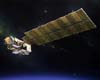 Woodland Hills CA (SPX) Nov 05, 2004
A key navigation aid from Northrop Grumman is supplying attitude reference, or satellite orientation, information critical to NASA's Aura Earth Observing System (EOS) satellite, and to a key scientific instrument aboard it. Precise satellite orientation information will facilitate Aura's mission to answer questions about changes in the Earth's environment and climate changes.
|
| |||||||||||
| The content herein, unless otherwise known to be public domain, are Copyright 1995-2016 - Space Media Network. All websites are published in Australia and are solely subject to Australian law and governed by Fair Use principals for news reporting and research purposes. AFP, UPI and IANS news wire stories are copyright Agence France-Presse, United Press International and Indo-Asia News Service. ESA news reports are copyright European Space Agency. All NASA sourced material is public domain. Additional copyrights may apply in whole or part to other bona fide parties. Advertising does not imply endorsement, agreement or approval of any opinions, statements or information provided by Space Media Network on any Web page published or hosted by Space Media Network. Privacy Statement All images and articles appearing on Space Media Network have been edited or digitally altered in some way. Any requests to remove copyright material will be acted upon in a timely and appropriate manner. Any attempt to extort money from Space Media Network will be ignored and reported to Australian Law Enforcement Agencies as a potential case of financial fraud involving the use of a telephonic carriage device or postal service. |