| . |  |
. |
With the rapid growth of Web mapping services, GlobeXplorer has announced the formation of a new sales team focused on vertical market integration. This group of leading industry veterans is a key part of GlobeXplorer's plan to lead the aerial and satellite imagery business into its next phase of online Web services. Joining the team as Senior Director of Sales and Channel Development is Eric Waldman, who will head up GlobeXplorer's growth plans in the mapping/AEC market, the federal government and visualization/simulation sectors. Waldman brings 19 years of sales, management, and business development experience in the spatial industry to GlobeXplorer. His background includes extensive work in the aerial imagery, simulation and civil engineering arenas. He most recently served as head of Sales for GIS Express and before that, worked with EarthScan Network and Space Imaging. Waldman was recently honored as DigitalGlobe's 2003 Reseller of the Year and Quick Bird Representative of the Year and is looking forward to leveraging the size and power of GlobeXplorer's imagery technology. "Joining GlobeXplorer allows me to tap into the largest online database available in the industry today," he said, "and provides state of the art, Web-based delivery systems that can better meet my clients' growing image requirements." Waldman's hiring comes on the heels of Andrew Pitcairn's recent move into the GlobeXplorer team as head of Business Development and Strategic Sales. Pitcairn brings 25 years of experience in the spatial industry, having worked in senior roles for the likes of Etak (now TeleAtlas), Trimble and AOL's MapQuest. He has been focusing on developing GlobeXplorer's relationships in the real estate, insurance, GIS, and location-based services sectors. "Eric and Andrew are proven performers anchoring a team that is second to none in the spatial information business," said COO Paul Smith. "With the support of our inside sales team, we hope to continue strong revenue growth in 2004." Related Links GlobeXplorer SpaceDaily Search SpaceDaily Subscribe To SpaceDaily Express  Davis - Jan 29, 2004
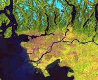
Finding better ways to handle satellite data as it pours down to Earth is the aim of the GeoStreams research project at UC Davis, funded by an $800,000 grant from the National Science Foundation's Information Technology Research program.
|
| ||||||||||
| The content herein, unless otherwise known to be public domain, are Copyright 1995-2016 - Space Media Network. All websites are published in Australia and are solely subject to Australian law and governed by Fair Use principals for news reporting and research purposes. AFP, UPI and IANS news wire stories are copyright Agence France-Presse, United Press International and Indo-Asia News Service. ESA news reports are copyright European Space Agency. All NASA sourced material is public domain. Additional copyrights may apply in whole or part to other bona fide parties. Advertising does not imply endorsement, agreement or approval of any opinions, statements or information provided by Space Media Network on any Web page published or hosted by Space Media Network. Privacy Statement All images and articles appearing on Space Media Network have been edited or digitally altered in some way. Any requests to remove copyright material will be acted upon in a timely and appropriate manner. Any attempt to extort money from Space Media Network will be ignored and reported to Australian Law Enforcement Agencies as a potential case of financial fraud involving the use of a telephonic carriage device or postal service. |