| . |  |
. |
 Austin - October 20, 1999 - Using data collected from a Canadian satellite, scientists studying the West Antarctic ice sheet have discovered a dynamic system of ice streams and their tributaries that make the ice sheet a far more intricate structure than was previously known.
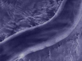
Dr. David Morse, research associate at the Institute for Geophysics at The University of Texas at Austin, said the project has important implications for scientists seeking to predict changes in sea level related to the gradual shrinking of the West Antarctic ice sheet. However, the discoveries are exciting in their own right because they reveal new information about the spectacular rivers of ice that flow across the Earth's fifth-largest continent. Antarctica is buried under two enormous ice sheets, seven million cubic miles in volume, with an average depth of 6,900 feet. These ice sheets store more than 90 percent of the earth's fresh water. The West Antarctic ice sheet, the smaller of the two, contains enough water to raise sea level between 15 and 20 feet. Glaciologists are trying to learn more about its behavior in response to changing climate. Morse explained that the ice sheet is not a solid, motionless block, but a dynamic structure flowing continuously toward the sea. "The flow of the ice sheet is organized into what are called ice streams -- rivers of ice that are tens of kilometers wide and hundreds of kilometers long," Morse said. "Ice streams are stunning things to behold. They may flow as much as a hundred times faster than the surrounding ice. They are so unlike the surrounding ice that they are easily seen from space. "The key to understanding the past and future behavior of the ice sheet as a whole is to understand the ice streams and how they may evolve." Morse worked with a group of scientists reviewing measurements of ice sheet movements collected for the first time in Antarctica by satellite. Ice velocity previously has been measured by pounding a stake into the ice and taking measurements as the stake moves slowly along with the ice itself. Morse said satellite data allowed a continuous measurement of velocities over large enough areas to give scientists a much clearer picture of the physics of ice movement. The satellite information was examined by scientists at NASA's Jet Propulsion Laboratory and the Canadian Space Agency to produce a new map of ice surface velocities in a largely unexplored region further inland from previously identified ice streams. Combining this information with ground-based velocity observations made by NASA scientists as well as ice thickness measurements collected by the SOAR airborne geophysics groups at UT Austin, scientists made three important discoveries:
The study was financed by several agencies, including NASA, the National Science Foundation and the Canada Center for Remote Sensing. The measurements were part of a project to produce a high-resolution satellite map of the entire continent. Morse said the West Antarctic ice sheet "has disintegrated and reappeared through the geologic record. The question is when will it do it again." Many scientists believe the ice sheet collapsed completely about 400,000 years ago and built back up again. There also is convincing evidence that the ice sheet has been shrinking steadily for the past 10,000 years, Morse said. Morse said the next step for researchers would be to use the ice velocity and thickness data to support "much more sophisticated ice sheet dynamics models to help interpret the results." The data also can be used to identify promising sites for further field studies in Antarctica. The study was published along with two other articles that document aspects of the ice sheet's changing behavior since the last ice age in the journal Science.
TERRADAILY.COM
|
| |||||||||
| The content herein, unless otherwise known to be public domain, are Copyright 1995-2016 - Space Media Network. All websites are published in Australia and are solely subject to Australian law and governed by Fair Use principals for news reporting and research purposes. AFP, UPI and IANS news wire stories are copyright Agence France-Presse, United Press International and Indo-Asia News Service. ESA news reports are copyright European Space Agency. All NASA sourced material is public domain. Additional copyrights may apply in whole or part to other bona fide parties. Advertising does not imply endorsement, agreement or approval of any opinions, statements or information provided by Space Media Network on any Web page published or hosted by Space Media Network. Privacy Statement All images and articles appearing on Space Media Network have been edited or digitally altered in some way. Any requests to remove copyright material will be acted upon in a timely and appropriate manner. Any attempt to extort money from Space Media Network will be ignored and reported to Australian Law Enforcement Agencies as a potential case of financial fraud involving the use of a telephonic carriage device or postal service. |
 Santiago (AFP) Oct 18, 1999 - The gigantic iceberg that broke off from the Antarctic in 1992 continues to drift toward the south Atlantic, the Chilean Antarctic Institute annouced Friday. On Wednesday, the iceberg, dubbed "B10A," was situated at 58.58 degrees south and 55.34 degrees west, heading toward the northeast at between seven and nine nautical miles a day, according to satellite measurments. If the iceberg's trajectory does not vary in the next month, it will approach the Falkland Islands, 3,000 kilometers (1,800 miles) east of Argentina.